Saint-Thomas-en-Royans geodata
Saint-Thomas-en-Royans (Auvergne-Rhône-Alpes) is a populated place; located in France in Europe/Paris (GMT+2) time zone. With population of 503 people, there are 15179 cities with bigger population in this country. Compared to other cities in France, 79.1% of cities are located further ↑North; 80.6% of cities are located further ←West and 70.1% of cities have lower elevation than Saint-Thomas-en-Royans. Note1
Administrative division(s):
- Level 1: Auvergne-Rhône-Alpes
- Level 2: Département de la Drôme
- Level 3: Arrondissement de Die
- Level 4: Saint-Thomas-en-Royans
Current local time in Saint-Thomas-en-Royans:
06:13 PM, SaturdayDifference from your time zone: hours


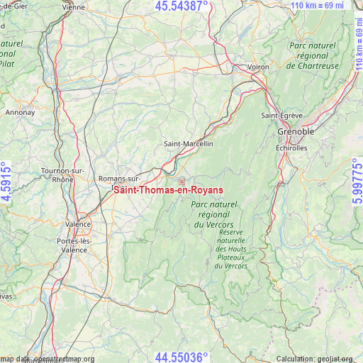
Saint-Thomas-en-Royans GPS coordinates[2]
45° 2' 57.372" North, 5° 17' 40.632" East
| Map corner | latitude | longitude |
|---|---|---|
| Upper-left | 45.54387°, | 4.5915° |
| Center: | 45.04927°, | 5.29462° |
| Lower-right: | 44.55036°, | 5.99775° |
| Map W x H: | 110.5×110.5 km | = 68.7×68.7mi |
| max Lat: | 51.07786° ⇑79.1% North |
| Saint-Thomas-en-Royans: | 45.04927° |
| min Lat: | ⇓20.9% South 41.3874° |
| min Long | Saint-Thomas-en | max Long |
| -5.08615° | 5.29462° | 9.52242° |
| W 80.6%⇐ | ⇒19.4% E |
Elevation
Elevation of Saint-Thomas-en-Royans is 220 m = 722 ft, and this is 26.3 m = 86 ft above average elevation for this country.
| Max E: |
2333 m = 7654 ft | 29.9% |
| Saint-Thomas-en-Royans | 220 m 722 ft | |
| Avg. | 193.7 m = 635 ft | |
Min E: |
-1 m = -3 ft | 70.1% |
See also: France elevation on elevation.city.
Geographical zone
Saint-Thomas-en-Royans is located in North temperate zone (between Tropic of Cancer and the Arctic Circle). Distance of this North polar circle is 2392.2 km =1486.4 mi to North.| Distance of | km | miles | from Saint-Thomas-en-Royans |
|---|---|---|---|
| North Pole | 4998.1 | 3105.7 | to North |
| Arctic Circle | 2392.2 | 1486.4 | to North |
| Tropic Cancer | 2403.1 | 1493.2 | to South |
| Equator | 5009 | 3112.4 | to South |


Nearby cities:
15 places around Saint-Thomas-en-Royans: (largest is in red/bold)
• Beauregard
10.3 km =6.4 mi,  235°
235°
• Eymeux
9.6 km =6 mi,  288°
288°
• Hostun
7.6 km =4.7 mi,  256°
256°
• Jaillans
9.7 km =6 mi, 256°
• La Sône
7 km =4.3 mi,  349°
349°
• Pont-en-Royans
3.9 km =2.4 mi,  67°
67°
• Saint-Bonnet-de-Chavagne
9.9 km =6.2 mi,  329°
329°
• Saint-Hilaire-du-Rosier
6.6 km =4.1 mi, 327°
• Saint-Jean-en-Royans
3.3 km =2.1 mi,  183°
183°
• Saint-Just-de-Claix
3.1 km =1.9 mi,  342°
342°
• Saint-Lattier
8.4 km =5.2 mi,  301°
301°
• Saint-Laurent-en-Royans
3.6 km =2.2 mi,  135°
135°
• Saint-Nazaire-en-Royans
3.7 km =2.3 mi, 289°
• Saint-Romans
7.4 km =4.6 mi,  17°
17°
• Sainte-Eulalie-en-Royans
4.4 km =2.7 mi,  88°
88°
Sources, notices
• [Note1] Compared only with cities in France existing in our database
• [Src1] Map data: © OpenStreetMap contributors (CC-BY-SA)
• [Src2] Other city data from geonames.org with taken over terms of usage.
• [Src3] Geographical zone / Annual Mean Temperature by Robert A. Rohde @ Wikipedia
