Laon geodata
Laon (Hauts-de-France) is a seat of a second-order administrative division; located in France in Europe/Paris (GMT+2) time zone. With population of 28,688 people, there are 295 cities with bigger population in this country. Compared to other cities in France, 90.1% of cities are located further ↓South; 65.2% of cities are located further ←West and 71% of cities have higher elevation than Laon. Note1
Administrative division(s):
- Level 1: Hauts-de-France
- Level 2: Département de l'Aisne
- Level 3: Arrondissement de Laon
- Level 4: Laon


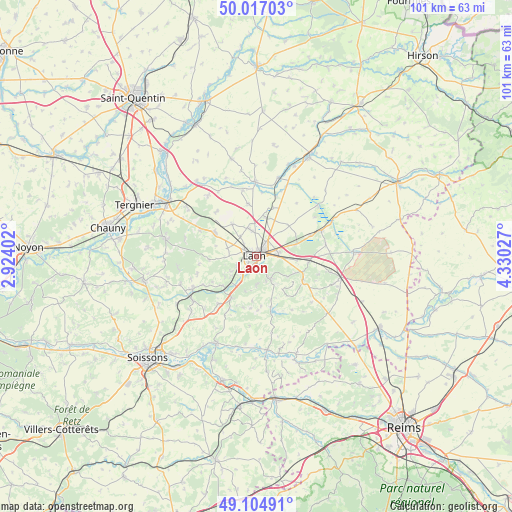
Laon GPS coordinates[2]
49° 33' 47.16" North, 3° 37' 37.704" East
| Map corner | latitude | longitude |
|---|---|---|
| Upper-left | 50.01703°, | 2.92402° |
| Center: | 49.5631°, | 3.62714° |
| Lower-right: | 49.10491°, | 4.33027° |
| Map W x H: | 101.4×101.4 km | = 63×63mi |
| max Lat: | 51.07786° ⇑9.9% North |
| Laon: | 49.5631° |
| min Lat: | ⇓90.1% South 41.3874° |
| min Long | Laon | max Long |
| -5.08615° | 3.62714° | 9.52242° |
| W 65.2%⇐ | ⇒34.8% E |
Elevation
Elevation of Laon is 76 m = 249 ft, and this is 117.7 m = 386 ft below average elevation for this country.
| Max E: |
2333 m = 7654 ft | 71% |
| Avg. | 193.7 m = 635 ft | |
| Laon | 76 m = 249 ft | |
Min E: |
-1 m = -3 ft | 29% |
See also: France elevation on elevation.city.
Geographical zone
Laon is located in North temperate zone (between Tropic of Cancer and the Arctic Circle). Distance of this North polar circle is 1890.3 km =1174.6 mi to North.| Distance of | km | miles | from Laon |
|---|---|---|---|
| North Pole | 4496.2 | 2793.8 | to North |
| Arctic Circle | 1890.3 | 1174.6 | to North |
| Tropic Cancer | 2905 | 1805.1 | to South |
| Equator | 5510.9 | 3424.3 | to South |


Nearby cities:
15 places around Laon: (largest is in red/bold)
• Athies-sous-Laon
4.3 km =2.7 mi,  74°
74°
• Aulnois-sous-Laon
5.9 km =3.7 mi,  344°
344°
• Barenton-Bugny
8 km =5 mi,  12°
12°
• Bruyères-et-Montbérault
5 km =3.1 mi,  147°
147°
• Chambry
4 km =2.5 mi,  34°
34°
• Chavignon
12 km =7.5 mi,  219°
219°
• Chivy-lès-Étouvelles
5.2 km =3.2 mi, 222°
• Chéry-lès-Pouilly
10.6 km =6.6 mi,  350°
350°
• Coucy-lès-Eppes
10.5 km =6.5 mi,  95°
95°
• Couvron-et-Aumencourt
12 km =7.5 mi,  319°
319°
• Crépy
9 km =5.6 mi,  297°
297°
• Festieux
10.3 km =6.4 mi,  115°
115°
• Gizy
11.4 km =7.1 mi, 68°
• Urcel
9.3 km =5.8 mi,  212°
212°
• Vivaise
8 km =5 mi, 323°
Sources, notices
• [Note1] Compared only with cities in France existing in our database
• [Src1] Map data: © OpenStreetMap contributors (CC-BY-SA)
• [Src2] Other city data from geonames.org with taken over terms of usage.
• [Src3] Geographical zone / Annual Mean Temperature by Robert A. Rohde @ Wikipedia
