Athies-sous-Laon geodata
Athies-sous-Laon (Hauts-de-France) is a populated place; located in France in Europe/Paris (GMT+2) time zone. With population of 2,160 people, there are 4455 cities with bigger population in this country. Compared to other cities in France, 90.3% of cities are located further ↓South; 65.6% of cities are located further ←West and 72.6% of cities have higher elevation than Athies-sous-Laon. Note1
Administrative division(s):
- Level 1: Hauts-de-France
- Level 2: Département de l'Aisne
- Level 3: Arrondissement de Laon
- Level 4: Athies-sous-Laon


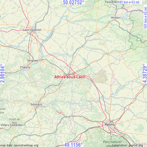
Athies-sous-Laon GPS coordinates[2]
49° 34' 25.284" North, 3° 41' 3.012" East
| Map corner | latitude | longitude |
|---|---|---|
| Upper-left | 50.02752°, | 2.98104° |
| Center: | 49.57369°, | 3.68417° |
| Lower-right: | 49.1156°, | 4.38729° |
| Map W x H: | 101.4×101.4 km | = 63×63mi |
| max Lat: | 51.07786° ⇑9.7% North |
| Athies-sous-Laon: | 49.57369° |
| min Lat: | ⇓90.3% South 41.3874° |
| min Long | Athies-sous-Lao | max Long |
| -5.08615° | 3.68417° | 9.52242° |
| W 65.6%⇐ | ⇒34.4% E |
Elevation
Elevation of Athies-sous-Laon is 72 m = 236 ft, and this is 121.7 m = 399 ft below average elevation for this country.
| Max E: |
2333 m = 7654 ft | 72.6% |
| Avg. | 193.7 m = 635 ft | |
| Athies-sous-Laon | 72 m = 236 ft | |
Min E: |
-1 m = -3 ft | 27.4% |
See also: France elevation on elevation.city.
Geographical zone
Athies-sous-Laon is located in North temperate zone (between Tropic of Cancer and the Arctic Circle). Distance of this North polar circle is 1889.1 km =1173.8 mi to North.| Distance of | km | miles | from Athies-sous-Laon |
|---|---|---|---|
| North Pole | 4495 | 2793.1 | to North |
| Arctic Circle | 1889.1 | 1173.8 | to North |
| Tropic Cancer | 2906.2 | 1805.8 | to South |
| Equator | 5512.1 | 3425.1 | to South |


Nearby cities:
15 places around Athies-sous-Laon: (largest is in red/bold)
• Aulnois-sous-Laon
7.2 km =4.5 mi,  308°
308°
• Barenton-Bugny
7 km =4.3 mi,  340°
340°
• Bruyères-et-Montbérault
5.6 km =3.5 mi,  195°
195°
• Chambry
2.8 km =1.7 mi,  317°
317°
• Chivy-lès-Étouvelles
9.1 km =5.7 mi,  236°
236°
• Chéry-lès-Pouilly
11 km =6.8 mi,  328°
328°
• Coucy-lès-Eppes
6.8 km =4.2 mi,  109°
109°
• Crépy
12.4 km =7.7 mi,  283°
283°
• Festieux
7.7 km =4.8 mi,  137°
137°
• Gizy
7.2 km =4.5 mi,  64°
64°
• Laon
4.3 km =2.7 mi,  254°
254°
• Liesse-Notre-Dame
9.6 km =6 mi, 60°
• Montaigu
11.4 km =7.1 mi, 112°
• Urcel
12.9 km =8 mi,  225°
225°
• Vivaise
10.3 km =6.4 mi,  300°
300°
Sources, notices
• [Note1] Compared only with cities in France existing in our database
• [Src1] Map data: © OpenStreetMap contributors (CC-BY-SA)
• [Src2] Other city data from geonames.org with taken over terms of usage.
• [Src3] Geographical zone / Annual Mean Temperature by Robert A. Rohde @ Wikipedia
