Ballan-Miré geodata
Ballan-Miré (Centre) is a populated place; located in France in Europe/Paris (GMT+2) time zone. With population of 7,398 people, there are 1324 cities with bigger population in this country. Compared to other cities in France, 50.9% of cities are located further ↑North; 72.2% of cities are located further →East and 64% of cities have higher elevation than Ballan-Miré. Note1
Administrative division(s):
- Level 1: Centre
- Level 2: Département d'Indre-et-Loire
- Level 3: Arrondissement de Tours
- Level 4: Ballan-Miré


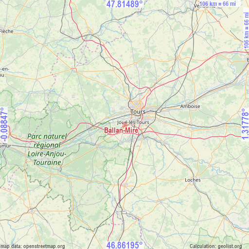
Ballan-Miré GPS coordinates[2]
47° 20' 26.052" North, 0° 36' 52.776" East
| Map corner | latitude | longitude |
|---|---|---|
| Upper-left | 47.81489°, | -0.08847° |
| Center: | 47.34057°, | 0.61466° |
| Lower-right: | 46.86195°, | 1.31778° |
| Map W x H: | 106×106 km | = 65.9×65.9mi |
| max Lat: | 51.07786° ⇑50.9% North |
| Ballan-Miré: | 47.34057° |
| min Lat: | ⇓49.1% South 41.3874° |
| min Long | Ballan-Miré | max Long |
| -5.08615° | 0.61466° | 9.52242° |
| W 27.8%⇐ | ⇒72.2% E |
Elevation
Elevation of Ballan-Miré is 92 m = 302 ft, and this is 101.7 m = 334 ft below average elevation for this country.
| Max E: |
2333 m = 7654 ft | 64% |
| Avg. | 193.7 m = 635 ft | |
| Ballan-Miré | 92 m = 302 ft | |
Min E: |
-1 m = -3 ft | 36% |
See also: France elevation on elevation.city.
Geographical zone
Ballan-Miré is located in North temperate zone (between Tropic of Cancer and the Arctic Circle). Distance of this North polar circle is 2137.4 km =1328.1 mi to North.| Distance of | km | miles | from Ballan-Miré |
|---|---|---|---|
| North Pole | 4743.3 | 2947.3 | to North |
| Arctic Circle | 2137.4 | 1328.1 | to North |
| Tropic Cancer | 2657.9 | 1651.5 | to South |
| Equator | 5263.8 | 3270.8 | to South |


Nearby cities:
15 places around Ballan-Miré: (largest is in red/bold)
• Artannes-sur-Indre
7.4 km =4.6 mi,  188°
188°
• Berthenay
7.2 km =4.5 mi,  290°
290°
• Chambray-lès-Tours
6.7 km =4.2 mi,  94°
94°
• Druye
6.7 km =4.2 mi,  238°
238°
• Fondettes
7.1 km =4.4 mi,  349°
349°
• Joué-lès-Tours
4.3 km =2.7 mi,  72°
72°
• La Riche
6.9 km =4.3 mi,  37°
37°
• Luynes
6.6 km =4.1 mi,  317°
317°
• Monts
7.1 km =4.4 mi,  173°
173°
• Saint-Cyr-sur-Loire
7.7 km =4.8 mi,  30°
30°
• Saint-Genouph
4.3 km =2.7 mi,  343°
343°
• Saint-Étienne-de-Chigny
7.8 km =4.8 mi,  307°
307°
• Savonnières
5 km =3.1 mi,  279°
279°
• Tours
9 km =5.6 mi,  48°
48°
• Villandry
7.8 km =4.8 mi,  269°
269°
Sources, notices
• [Note1] Compared only with cities in France existing in our database
• [Src1] Map data: © OpenStreetMap contributors (CC-BY-SA)
• [Src2] Other city data from geonames.org with taken over terms of usage.
• [Src3] Geographical zone / Annual Mean Temperature by Robert A. Rohde @ Wikipedia
