Dieuze geodata
Dieuze (Grand Est) is a populated place; located in France in Europe/Paris (GMT+2) time zone. With population of 4,140 people, there are 2371 cities with bigger population in this country. Compared to other cities in France, 75.7% of cities are located further ↓South; 93.1% of cities are located further ←West and 67.8% of cities have lower elevation than Dieuze. Note1
Administrative division(s):
- Level 1: Grand Est
- Level 2: Moselle
- Level 3: Arrondissement de Sarrebourg-Château-Salins
- Level 4: Dieuze


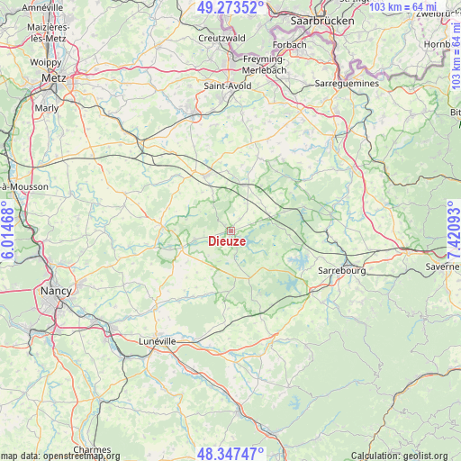
Dieuze GPS coordinates[2]
48° 48' 45.468" North, 6° 43' 4.08" East
| Map corner | latitude | longitude |
|---|---|---|
| Upper-left | 49.27352°, | 6.01468° |
| Center: | 48.81263°, | 6.7178° |
| Lower-right: | 48.34747°, | 7.42093° |
| Map W x H: | 103×103 km | = 64×64mi |
| max Lat: | 51.07786° ⇑24.3% North |
| Dieuze: | 48.81263° |
| min Lat: | ⇓75.7% South 41.3874° |
| min Long | Dieuze | max Long |
| -5.08615° | 6.7178° | 9.52242° |
| W 93.1%⇐ | ⇒6.9% E |
Elevation
Elevation of Dieuze is 208 m = 682 ft, and this is 14.3 m = 47 ft above average elevation for this country.
| Max E: |
2333 m = 7654 ft | 32.2% |
| Dieuze | 208 m 682 ft | |
| Avg. | 193.7 m = 635 ft | |
Min E: |
-1 m = -3 ft | 67.8% |
See also: France elevation on elevation.city.
Geographical zone
Dieuze is located in North temperate zone (between Tropic of Cancer and the Arctic Circle). Distance of this North polar circle is 1973.7 km =1226.4 mi to North.| Distance of | km | miles | from Dieuze |
|---|---|---|---|
| North Pole | 4579.6 | 2845.6 | to North |
| Arctic Circle | 1973.7 | 1226.4 | to North |
| Tropic Cancer | 2821.5 | 1753.2 | to South |
| Equator | 5427.5 | 3372.5 | to South |


Nearby cities:
15 places around Dieuze: (largest is in red/bold)
• Albestroff
16.7 km =10.4 mi,  37°
37°
• Avricourt
19.1 km =11.9 mi,  161°
161°
• Bénestroff
10.6 km =6.6 mi,  16°
16°
• Château-Salins
14.9 km =9.3 mi,  272°
272°
• Francaltroff
17.6 km =10.9 mi, 19°
• Gosselming
20.9 km =13 mi,  96°
96°
• Grostenquin
18.7 km =11.6 mi,  4°
4°
• Insming
19.6 km =12.2 mi, 36°
• Mittersheim
17.3 km =10.7 mi,  71°
71°
• Morhange
13.5 km =8.4 mi,  335°
335°
• Moussey
16.2 km =10.1 mi, 163°
• Racrange
13 km =8.1 mi, 344°
• Réchicourt-le-Château
18.6 km =11.6 mi,  151°
151°
• Vergaville
3.5 km =2.2 mi, 35°
• Vic-sur-Seille
14.1 km =8.8 mi,  256°
256°
Sources, notices
• [Note1] Compared only with cities in France existing in our database
• [Src1] Map data: © OpenStreetMap contributors (CC-BY-SA)
• [Src2] Other city data from geonames.org with taken over terms of usage.
• [Src3] Geographical zone / Annual Mean Temperature by Robert A. Rohde @ Wikipedia
