Torcenay geodata
Torcenay (Grand Est) is a populated place; located in France in Europe/Paris (GMT+2) time zone. With population of 538 people, there are 14429 cities with bigger population in this country. Compared to other cities in France, 56% of cities are located further ↓South; 82.6% of cities are located further ←West and 83.1% of cities have lower elevation than Torcenay. Note1
Administrative division(s):
- Level 1: Grand Est
- Level 2: Haute-Marne
- Level 3: Arrondissement de Langres
- Level 4: Torcenay


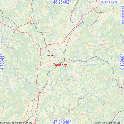
Torcenay GPS coordinates[2]
47° 48' 53.28" North, 5° 27' 59.508" East
| Map corner | latitude | longitude |
|---|---|---|
| Upper-left | 48.28482°, | 4.76341° |
| Center: | 47.8148°, | 5.46653° |
| Lower-right: | 47.34048°, | 6.16966° |
| Map W x H: | 105×105 km | = 65.2×65.2mi |
| max Lat: | 51.07786° ⇑44% North |
| Torcenay: | 47.8148° |
| min Lat: | ⇓56% South 41.3874° |
| min Long | Torcenay | max Long |
| -5.08615° | 5.46653° | 9.52242° |
| W 82.6%⇐ | ⇒17.4% E |
Elevation
Elevation of Torcenay is 322 m = 1056 ft, and this is 128.3 m = 421 ft above average elevation for this country.
| Max E: |
2333 m = 7654 ft | 16.9% |
| Torcenay | 322 m 1056 ft | |
| Avg. | 193.7 m = 635 ft | |
Min E: |
-1 m = -3 ft | 83.1% |
See also: France elevation on elevation.city.
Geographical zone
Torcenay is located in North temperate zone (between Tropic of Cancer and the Arctic Circle). Distance of this North polar circle is 2084.7 km =1295.4 mi to North.| Distance of | km | miles | from Torcenay |
|---|---|---|---|
| North Pole | 4690.6 | 2914.6 | to North |
| Arctic Circle | 2084.7 | 1295.4 | to North |
| Tropic Cancer | 2710.6 | 1684.3 | to South |
| Equator | 5316.5 | 3303.5 | to South |


Nearby cities:
15 places around Torcenay: (largest is in red/bold)
• Avrecourt
17.3 km =10.7 mi,  17°
17°
• Chalindrey
3.2 km =2 mi,  245°
245°
• Chézeaux
15.2 km =9.4 mi,  63°
63°
• Culmont
2 km =1.2 mi,  296°
296°
• Fayl-Billot
10.6 km =6.6 mi,  110°
110°
• Haute-Amance
6.6 km =4.1 mi,  71°
71°
• Humes-Jorquenay
16.6 km =10.3 mi, 304°
• Langres
11.3 km =7 mi, 298°
• Longeau-Percey
13.5 km =8.4 mi, 246°
• Prauthoy
19.8 km =12.3 mi,  220°
220°
• Rolampont
20.2 km =12.6 mi,  317°
317°
• Saints-Geosmes
10.2 km =6.3 mi,  281°
281°
• Saulxures
17.9 km =11.1 mi,  29°
29°
• Val-de-Meuse
20.7 km =12.9 mi,  6°
6°
• Villegusien-le-Lac
13.9 km =8.6 mi,  231°
231°
Sources, notices
• [Note1] Compared only with cities in France existing in our database
• [Src1] Map data: © OpenStreetMap contributors (CC-BY-SA)
• [Src2] Other city data from geonames.org with taken over terms of usage.
• [Src3] Geographical zone / Annual Mean Temperature by Robert A. Rohde @ Wikipedia
