Lucheux geodata
Lucheux (Hauts-de-France) is a populated place; located in France in Europe/Paris (GMT+2) time zone. With population of 618 people, there are 13020 cities with bigger population in this country. Compared to other cities in France, 94.8% of cities are located further ↓South; 50.9% of cities are located further →East and 64.9% of cities have higher elevation than Lucheux. Note1
Administrative division(s):
- Level 1: Hauts-de-France
- Level 2: Somme
- Level 3: Amiens
- Level 4: Lucheux


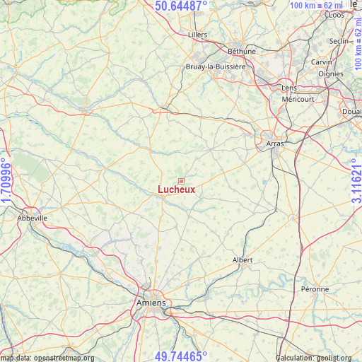
Lucheux GPS coordinates[2]
50° 11' 48.768" North, 2° 24' 47.124" East
| Map corner | latitude | longitude |
|---|---|---|
| Upper-left | 50.64487°, | 1.70996° |
| Center: | 50.19688°, | 2.41309° |
| Lower-right: | 49.74465°, | 3.11621° |
| Map W x H: | 100.1×100.1 km | = 62.2×62.2mi |
| max Lat: | 51.07786° ⇑5.2% North |
| Lucheux: | 50.19688° |
| min Lat: | ⇓94.8% South 41.3874° |
| min Long | Lucheux | max Long |
| -5.08615° | 2.41309° | 9.52242° |
| W 49.1%⇐ | ⇒50.9% E |
Elevation
Elevation of Lucheux is 90 m = 295 ft, and this is 103.7 m = 340 ft below average elevation for this country.
| Max E: |
2333 m = 7654 ft | 64.9% |
| Avg. | 193.7 m = 635 ft | |
| Lucheux | 90 m = 295 ft | |
Min E: |
-1 m = -3 ft | 35.1% |
See also: France elevation on elevation.city.
Geographical zone
Lucheux is located in North temperate zone (between Tropic of Cancer and the Arctic Circle). Distance of this North polar circle is 1819.8 km =1130.8 mi to North.| Distance of | km | miles | from Lucheux |
|---|---|---|---|
| North Pole | 4425.7 | 2750 | to North |
| Arctic Circle | 1819.8 | 1130.8 | to North |
| Tropic Cancer | 2975.5 | 1848.9 | to South |
| Equator | 5581.4 | 3468.1 | to South |


Nearby cities:
15 places around Lucheux: (largest is in red/bold)
• Acheux-en-Amiénois
16.2 km =10.1 mi,  148°
148°
• Avesnes-le-Comte
12.2 km =7.6 mi,  42°
42°
• Beauquesne
12.5 km =7.8 mi,  186°
186°
• Beauval
11.4 km =7.1 mi,  210°
210°
• Bonnières
12 km =7.5 mi,  295°
295°
• Boubers-sur-Canche
16.3 km =10.1 mi,  309°
309°
• Candas
14.8 km =9.2 mi,  227°
227°
• Doullens
6.8 km =4.2 mi, 229°
• Fienvillers
15.7 km =9.8 mi,  236°
236°
• Frévent
12.6 km =7.8 mi, 314°
• Izel-lès-Hameau
15.8 km =9.8 mi,  32°
32°
• Mondicourt
4.4 km =2.7 mi,  128°
128°
• Pas-en-Artois
7.3 km =4.5 mi, 131°
• Simencourt
17.7 km =11 mi,  67°
67°
• Wanquetin
16.8 km =10.4 mi,  58°
58°
Sources, notices
• [Note1] Compared only with cities in France existing in our database
• [Src1] Map data: © OpenStreetMap contributors (CC-BY-SA)
• [Src2] Other city data from geonames.org with taken over terms of usage.
• [Src3] Geographical zone / Annual Mean Temperature by Robert A. Rohde @ Wikipedia
