Availles-sur-Seiche geodata
Availles-sur-Seiche (Brittany) is a populated place; located in France in Europe/Paris (GMT+2) time zone. With population of 559 people, there are 14019 cities with bigger population in this country. Compared to other cities in France, 58.6% of cities are located further ↓South; 90% of cities are located further →East and 77.3% of cities have higher elevation than Availles-sur-Seiche. Note1
Administrative division(s):
- Level 1: Brittany
- Level 2: Département d'Ille-et-Vilaine
- Level 3: Arrondissement de Fougères-Vitré
- Level 4: Availles-sur-Seiche


Availles-sur-Seiche GPS coordinates[2]
47° 57' 41.112" North, 1° 11' 47.112" West
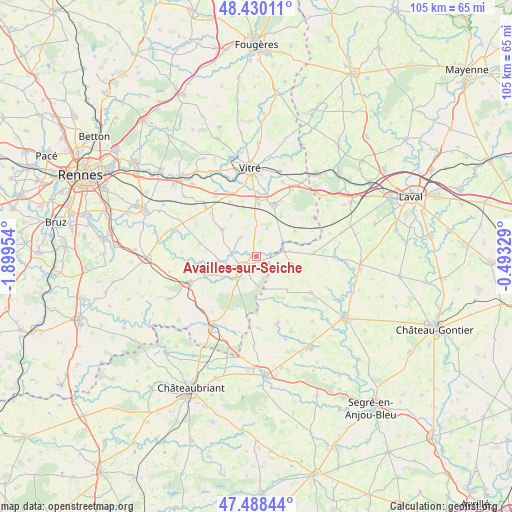
| Map corner | latitude | longitude |
|---|---|---|
| Upper-left | 48.43011°, | -1.89954° |
| Center: | 47.96142°, | -1.19642° |
| Lower-right: | 47.48844°, | -0.49329° |
| Map W x H: | 104.7×104.7 km | = 65.1×65.1mi |
| max Lat: | 51.07786° ⇑41.4% North |
| Availles-sur-Seiche: | 47.96142° |
| min Lat: | ⇓58.6% South 41.3874° |
| min Long | Availles-sur-Se | max Long |
| -5.08615° | -1.19642° | 9.52242° |
| W 10%⇐ | ⇒90% E |
Elevation
Elevation of Availles-sur-Seiche is 61 m = 200 ft, and this is 132.7 m = 435 ft below average elevation for this country.
| Max E: |
2333 m = 7654 ft | 77.3% |
| Avg. | 193.7 m = 635 ft | |
| Availles-sur-Seiche | 61 m = 200 ft | |
Min E: |
-1 m = -3 ft | 22.7% |
See also: France elevation on elevation.city.
Geographical zone
Availles-sur-Seiche is located in North temperate zone (between Tropic of Cancer and the Arctic Circle). Distance of this North polar circle is 2068.4 km =1285.2 mi to North.| Distance of | km | miles | from Availles-sur-Seiche |
|---|---|---|---|
| North Pole | 4674.3 | 2904.5 | to North |
| Arctic Circle | 2068.4 | 1285.2 | to North |
| Tropic Cancer | 2726.9 | 1694.4 | to South |
| Equator | 5332.8 | 3313.6 | to South |


Nearby cities:
15 places around Availles-sur-Seiche: (largest is in red/bold)
• Argentré-du-Plessis
11.3 km =7 mi,  19°
19°
• Bais
8.8 km =5.5 mi,  307°
307°
• Brielles
9.5 km =5.9 mi,  56°
56°
• Cuillé
5.8 km =3.6 mi,  79°
79°
• Domalain
5.2 km =3.2 mi,  318°
318°
• Gennes-sur-Seiche
6.2 km =3.9 mi, 61°
• La Guerche-de-Bretagne
3.3 km =2.1 mi,  226°
226°
• Marcillé-Robert
12.5 km =7.8 mi,  263°
263°
• Moutiers
1.4 km =0.9 mi,  294°
294°
• Rannée
5.3 km =3.3 mi,  218°
218°
• Saint-Germain-du-Pinel
6.1 km =3.8 mi, 21°
• Torcé
12.3 km =7.6 mi,  334°
334°
• Vergéal
9.8 km =6.1 mi, 328°
• Visseiche
7.9 km =4.9 mi,  265°
265°
• Étrelles
11 km =6.8 mi,  0°
0°
Sources, notices
• [Note1] Compared only with cities in France existing in our database
• [Src1] Map data: © OpenStreetMap contributors (CC-BY-SA)
• [Src2] Other city data from geonames.org with taken over terms of usage.
• [Src3] Geographical zone / Annual Mean Temperature by Robert A. Rohde @ Wikipedia
