Esprels geodata
Esprels (Bourgogne-Franche-Comté) is a populated place; located in France in Europe/Paris (GMT+2) time zone. With population of 698 people, there are 11822 cities with bigger population in this country. Compared to other cities in France, 51.8% of cities are located further ↓South; 90.9% of cities are located further ←West and 76.5% of cities have lower elevation than Esprels. Note1
Administrative division(s):
- Level 1: Bourgogne-Franche-Comté
- Level 2: Département de la Haute-Saône
- Level 3: Arrondissement de Lure
- Level 4: Esprels


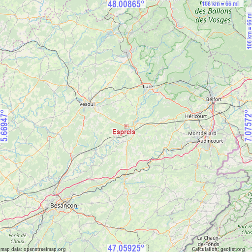
Esprels GPS coordinates[2]
47° 32' 9.96" North, 6° 22' 21.324" East
| Map corner | latitude | longitude |
|---|---|---|
| Upper-left | 48.00865°, | 5.66947° |
| Center: | 47.5361°, | 6.37259° |
| Lower-right: | 47.05925°, | 7.07572° |
| Map W x H: | 105.6×105.6 km | = 65.6×65.6mi |
| max Lat: | 51.07786° ⇑48.2% North |
| Esprels: | 47.5361° |
| min Lat: | ⇓51.8% South 41.3874° |
| min Long | Esprels | max Long |
| -5.08615° | 6.37259° | 9.52242° |
| W 90.9%⇐ | ⇒9.1% E |
Elevation
Elevation of Esprels is 260 m = 853 ft, and this is 66.3 m = 218 ft above average elevation for this country.
| Max E: |
2333 m = 7654 ft | 23.5% |
| Esprels | 260 m 853 ft | |
| Avg. | 193.7 m = 635 ft | |
Min E: |
-1 m = -3 ft | 76.5% |
See also: France elevation on elevation.city.
Geographical zone
Esprels is located in North temperate zone (between Tropic of Cancer and the Arctic Circle). Distance of this North polar circle is 2115.7 km =1314.6 mi to North.| Distance of | km | miles | from Esprels |
|---|---|---|---|
| North Pole | 4721.5 | 2933.8 | to North |
| Arctic Circle | 2115.7 | 1314.6 | to North |
| Tropic Cancer | 2679.6 | 1665 | to South |
| Equator | 5285.5 | 3284.3 | to South |


Nearby cities:
15 places around Esprels: (largest is in red/bold)
• Athesans-Étroitefontaine
12.9 km =8 mi,  56°
56°
• Clerval
18.7 km =11.6 mi,  149°
149°
• Dampierre-sur-Linotte
10.9 km =6.8 mi,  254°
254°
• Frotey-lès-Lure
18.9 km =11.7 mi,  45°
45°
• Frotey-lès-Vesoul
16.7 km =10.4 mi,  304°
304°
• Lure
18.8 km =11.7 mi,  29°
29°
• Magny-Vernois
16.8 km =10.4 mi, 27°
• Moffans-et-Vacheresse
17 km =10.6 mi, 52°
• Navenne
17.8 km =11.1 mi, 297°
• Quincey
16.4 km =10.2 mi, 300°
• Rougemont
6.1 km =3.8 mi,  191°
191°
• Villers-le-Sec
13.4 km =8.3 mi, 301°
• Villersexel
4.8 km =3 mi,  70°
70°
• Vy-lès-Lure
13.3 km =8.3 mi,  23°
23°
• Échenoz-la-Méline
19.2 km =11.9 mi,  292°
292°
Sources, notices
• [Note1] Compared only with cities in France existing in our database
• [Src1] Map data: © OpenStreetMap contributors (CC-BY-SA)
• [Src2] Other city data from geonames.org with taken over terms of usage.
• [Src3] Geographical zone / Annual Mean Temperature by Robert A. Rohde @ Wikipedia
