Loigné-sur-Mayenne geodata
Loigné-sur-Mayenne (Pays de la Loire) is a populated place; located in France in Europe/Paris (GMT+2) time zone. With population of 742 people, there are 11263 cities with bigger population in this country. Compared to other cities in France, 57% of cities are located further ↓South; 86% of cities are located further →East and 68.7% of cities have higher elevation than Loigné-sur-Mayenne. Note1
Administrative division(s):
- Level 1: Pays de la Loire
- Level 2: Mayenne
- Level 3: Arrondissement de Château-Gontier
- Level 4: La Roche-Neuville


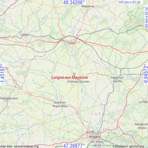
Loigné-sur-Mayenne GPS coordinates[2]
47° 52' 21.216" North, 0° 44' 55.824" West
| Map corner | latitude | longitude |
|---|---|---|
| Upper-left | 48.34206°, | -1.45197° |
| Center: | 47.87256°, | -0.74884° |
| Lower-right: | 47.39877°, | -0.04572° |
| Map W x H: | 104.9×104.9 km | = 65.2×65.2mi |
| max Lat: | 51.07786° ⇑43% North |
| Loigné-sur-Mayenne: | 47.87256° |
| min Lat: | ⇓57% South 41.3874° |
| min Long | Loigné-sur-May | max Long |
| -5.08615° | -0.74884° | 9.52242° |
| W 14%⇐ | ⇒86% E |
Elevation
Elevation of Loigné-sur-Mayenne is 81 m = 266 ft, and this is 112.7 m = 370 ft below average elevation for this country.
| Max E: |
2333 m = 7654 ft | 68.7% |
| Avg. | 193.7 m = 635 ft | |
| Loigné-sur-Mayenne | 81 m = 266 ft | |
Min E: |
-1 m = -3 ft | 31.3% |
See also: France elevation on elevation.city.
Geographical zone
Loigné-sur-Mayenne is located in North temperate zone (between Tropic of Cancer and the Arctic Circle). Distance of this North polar circle is 2078.2 km =1291.3 mi to North.| Distance of | km | miles | from Loigné-sur-Mayenne |
|---|---|---|---|
| North Pole | 4684.1 | 2910.6 | to North |
| Arctic Circle | 2078.2 | 1291.3 | to North |
| Tropic Cancer | 2717 | 1688.3 | to South |
| Equator | 5322.9 | 3307.5 | to South |


Nearby cities:
15 places around Loigné-sur-Mayenne: (largest is in red/bold)
• Astillé
12.7 km =7.9 mi,  322°
322°
• Azé
7.4 km =4.6 mi,  138°
138°
• Chemazé
9.7 km =6 mi,  191°
191°
• Château-Gontier
6 km =3.7 mi, 144°
• Coudray
12 km =7.5 mi, 139°
• Fromentières
6.2 km =3.9 mi,  98°
98°
• Gennes-sur-Glaize
10.7 km =6.6 mi, 101°
• Laigné
6.2 km =3.9 mi,  237°
237°
• Marigné-Peuton
4.8 km =3 mi,  265°
265°
• Ménil
11.9 km =7.4 mi,  153°
153°
• Nuillé-sur-Vicoin
12.8 km =8 mi,  348°
348°
• Pommerieux
12.4 km =7.7 mi, 243°
• Quelaines-Saint-Gault
7.8 km =4.8 mi,  330°
330°
• Saint-Fort
8.4 km =5.2 mi,  165°
165°
• Villiers-Charlemagne
7.7 km =4.8 mi,  44°
44°
Sources, notices
• [Note1] Compared only with cities in France existing in our database
• [Src1] Map data: © OpenStreetMap contributors (CC-BY-SA)
• [Src2] Other city data from geonames.org with taken over terms of usage.
• [Src3] Geographical zone / Annual Mean Temperature by Robert A. Rohde @ Wikipedia
