Ahuillé geodata
Ahuillé (Pays de la Loire) is a populated place; located in France in Europe/Paris (GMT+2) time zone. With population of 1,451 people, there are 6376 cities with bigger population in this country. Compared to other cities in France, 59.6% of cities are located further ↓South; 87% of cities are located further →East and 59.7% of cities have higher elevation than Ahuillé. Note1
Administrative division(s):
- Level 1: Pays de la Loire
- Level 2: Mayenne
- Level 3: Arrondissement de Laval
- Level 4: Ahuillé


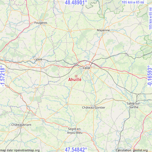
Ahuillé GPS coordinates[2]
48° 1' 15.096" North, 0° 52' 8.616" West
| Map corner | latitude | longitude |
|---|---|---|
| Upper-left | 48.48901°, | -1.57218° |
| Center: | 48.02086°, | -0.86906° |
| Lower-right: | 47.54842°, | -0.16593° |
| Map W x H: | 104.6×104.6 km | = 65×65mi |
| max Lat: | 51.07786° ⇑40.4% North |
| Ahuillé: | 48.02086° |
| min Lat: | ⇓59.6% South 41.3874° |
| min Long | Ahuillé | max Long |
| -5.08615° | -0.86906° | 9.52242° |
| W 13%⇐ | ⇒87% E |
Elevation
Elevation of Ahuillé is 103 m = 338 ft, and this is 90.7 m = 298 ft below average elevation for this country.
| Max E: |
2333 m = 7654 ft | 59.7% |
| Avg. | 193.7 m = 635 ft | |
| Ahuillé | 103 m = 338 ft | |
Min E: |
-1 m = -3 ft | 40.3% |
See also: France elevation on elevation.city.
Geographical zone
Ahuillé is located in North temperate zone (between Tropic of Cancer and the Arctic Circle). Distance of this North polar circle is 2061.8 km =1281.1 mi to North.| Distance of | km | miles | from Ahuillé |
|---|---|---|---|
| North Pole | 4667.6 | 2900.3 | to North |
| Arctic Circle | 2061.8 | 1281.1 | to North |
| Tropic Cancer | 2733.5 | 1698.5 | to South |
| Equator | 5339.4 | 3317.7 | to South |


Nearby cities:
15 places around Ahuillé: (largest is in red/bold)
• Astillé
6.5 km =4 mi,  168°
168°
• Changé
10.4 km =6.5 mi,  33°
33°
• Cossé-le-Vivien
8.9 km =5.5 mi,  200°
200°
• Courbeveille
3.5 km =2.2 mi, 203°
• Entrammes
11.8 km =7.3 mi,  102°
102°
• La Brûlatte
9.6 km =6 mi,  318°
318°
• Laval
9.8 km =6.1 mi,  53°
53°
• Loiron
7 km =4.3 mi, 316°
• Montigné-le-Brillant
4.2 km =2.6 mi,  108°
108°
• Montjean
7.2 km =4.5 mi,  255°
255°
• Méral
10.7 km =6.6 mi,  231°
231°
• Nuillé-sur-Vicoin
7.5 km =4.7 mi,  121°
121°
• Quelaines-Saint-Gault
11 km =6.8 mi,  152°
152°
• Ruillé-le-Gravelais
7.5 km =4.7 mi,  302°
302°
• Saint-Berthevin
5.7 km =3.5 mi, 27°
Sources, notices
• [Note1] Compared only with cities in France existing in our database
• [Src1] Map data: © OpenStreetMap contributors (CC-BY-SA)
• [Src2] Other city data from geonames.org with taken over terms of usage.
• [Src3] Geographical zone / Annual Mean Temperature by Robert A. Rohde @ Wikipedia
