Amfreville geodata
Amfreville (Normandy) is a populated place; located in France in Europe/Paris (GMT+2) time zone. With population of 1,198 people, there are 7546 cities with bigger population in this country. Compared to other cities in France, 85.2% of cities are located further ↓South; 80.1% of cities are located further →East and 80.6% of cities have higher elevation than Amfreville. Note1
Administrative division(s):
- Level 1: Normandy
- Level 2: Calvados
- Level 3: Arrondissement de Lisieux
- Level 4: Amfreville


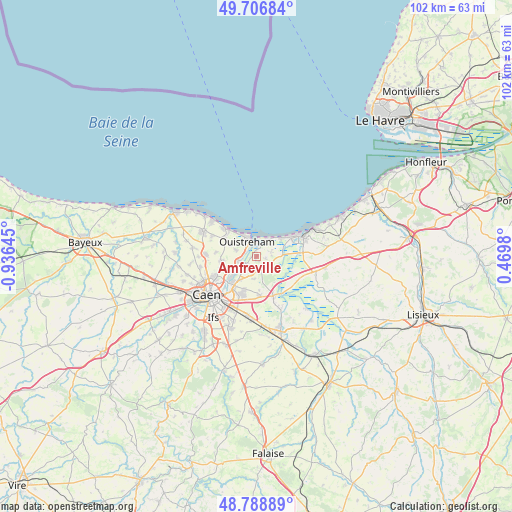
Amfreville GPS coordinates[2]
49° 15' 0" North, 0° 13' 59.988" West
| Map corner | latitude | longitude |
|---|---|---|
| Upper-left | 49.70684°, | -0.93645° |
| Center: | 49.25°, | -0.23333° |
| Lower-right: | 48.78889°, | 0.4698° |
| Map W x H: | 102.1×102.1 km | = 63.4×63.4mi |
| max Lat: | 51.07786° ⇑14.8% North |
| Amfreville: | 49.25° |
| min Lat: | ⇓85.2% South 41.3874° |
| min Long | Amfreville | max Long |
| -5.08615° | -0.23333° | 9.52242° |
| W 19.9%⇐ | ⇒80.1% E |
Elevation
Elevation of Amfreville is 53 m = 174 ft, and this is 140.7 m = 462 ft below average elevation for this country.
| Max E: |
2333 m = 7654 ft | 80.6% |
| Avg. | 193.7 m = 635 ft | |
| Amfreville | 53 m = 174 ft | |
Min E: |
-1 m = -3 ft | 19.4% |
See also: France elevation on elevation.city.
Geographical zone
Amfreville is located in North temperate zone (between Tropic of Cancer and the Arctic Circle). Distance of this North polar circle is 1925.1 km =1196.2 mi to North.| Distance of | km | miles | from Amfreville |
|---|---|---|---|
| North Pole | 4531 | 2815.4 | to North |
| Arctic Circle | 1925.1 | 1196.2 | to North |
| Tropic Cancer | 2870.2 | 1783.5 | to South |
| Equator | 5476.1 | 3402.7 | to South |


Nearby cities:
15 places around Amfreville: (largest is in red/bold)
• Bavent
4 km =2.5 mi,  123°
123°
• Beuville
6.8 km =4.2 mi,  263°
263°
• Biéville-Beuville
6.9 km =4.3 mi, 263°
• Blainville-sur-Orne
5.4 km =3.4 mi,  244°
244°
• Bréville-les-Monts
1.9 km =1.2 mi,  180°
180°
• Bénouville
3.7 km =2.3 mi, 255°
• Colleville-Montgomery
5.6 km =3.5 mi,  299°
299°
• Colombelles
6.8 km =4.2 mi,  222°
222°
• Escoville
4.4 km =2.7 mi,  185°
185°
• Hérouville-Saint-Clair
6.9 km =4.3 mi,  230°
230°
• Hérouvillette
3.3 km =2.1 mi, 193°
• Merville-Franceville-Plage
3.7 km =2.3 mi,  47°
47°
• Ouistreham
3.4 km =2.1 mi,  326°
326°
• Ranville
2.7 km =1.7 mi, 217°
• Varaville
5.4 km =3.4 mi,  86°
86°
Sources, notices
• [Note1] Compared only with cities in France existing in our database
• [Src1] Map data: © OpenStreetMap contributors (CC-BY-SA)
• [Src2] Other city data from geonames.org with taken over terms of usage.
• [Src3] Geographical zone / Annual Mean Temperature by Robert A. Rohde @ Wikipedia
