Saint-Martin-de-Bernegoue geodata
Saint-Martin-de-Bernegoue (Nouvelle-Aquitaine) is a populated place; located in France in Europe/Paris (GMT+2) time zone. With population of 734 people, there are 11362 cities with bigger population in this country. Compared to other cities in France, 63.1% of cities are located further ↑North; 81.3% of cities are located further →East and 73.6% of cities have higher elevation than Saint-Martin-de-Bernegoue. Note1
Administrative division(s):
- Level 1: Nouvelle-Aquitaine
- Level 2: Département des Deux-Sèvres
- Level 3: Arrondissement de Niort
- Level 4: Saint-Martin-de-Bernegoue
Current local time in Saint-Martin-de-Bernegoue:
01:37 PM, SaturdayDifference from your time zone: hours


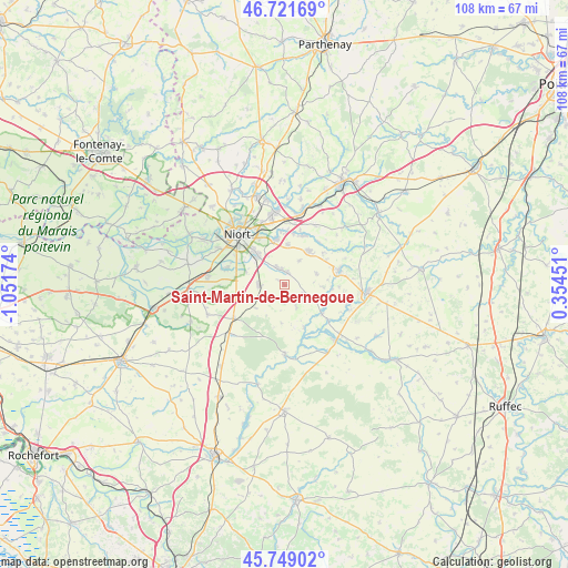
Saint-Martin-de-Bernegoue GPS coordinates[2]
46° 14' 15.036" North, 0° 20' 54.996" West
| Map corner | latitude | longitude |
|---|---|---|
| Upper-left | 46.72169°, | -1.05174° |
| Center: | 46.23751°, | -0.34861° |
| Lower-right: | 45.74902°, | 0.35451° |
| Map W x H: | 108.2×108.1 km | = 67.2×67.2mi |
| max Lat: | 51.07786° ⇑63.1% North |
| Saint-Martin-de-Bernegoue: | 46.23751° |
| min Lat: | ⇓36.9% South 41.3874° |
| min Long | Saint-Martin-de | max Long |
| -5.08615° | -0.34861° | 9.52242° |
| W 18.7%⇐ | ⇒81.3% E |
Elevation
Elevation of Saint-Martin-de-Bernegoue is 70 m = 230 ft, and this is 123.7 m = 406 ft below average elevation for this country.
| Max E: |
2333 m = 7654 ft | 73.6% |
| Avg. | 193.7 m = 635 ft | |
| Saint-Martin-de-Bernegoue | 70 m = 230 ft | |
Min E: |
-1 m = -3 ft | 26.4% |
See also: France elevation on elevation.city.
Geographical zone
Saint-Martin-de-Bernegoue is located in North temperate zone (between Tropic of Cancer and the Arctic Circle). Distance of this North polar circle is 2260 km =1404.3 mi to North.| Distance of | km | miles | from Saint-Martin-de-Bernegoue |
|---|---|---|---|
| North Pole | 4865.9 | 3023.5 | to North |
| Arctic Circle | 2260 | 1404.3 | to North |
| Tropic Cancer | 2535.2 | 1575.3 | to South |
| Equator | 5141.1 | 3194.5 | to South |


Nearby cities:
15 places around Saint-Martin-de-Bernegoue: (largest is in red/bold)
• Aiffres
7.6 km =4.7 mi,  318°
318°
• Beauvoir-sur-Niort
11.5 km =7.1 mi,  237°
237°
• Brûlain
4.5 km =2.8 mi,  151°
151°
• Celles-sur-Belle
10.9 km =6.8 mi,  75°
75°
• Fors
4.7 km =2.9 mi,  268°
268°
• Granzay-Gript
10.6 km =6.6 mi,  257°
257°
• Marigny
7 km =4.3 mi,  231°
231°
• Mougon
8 km =5 mi,  36°
36°
• Prahecq
2.4 km =1.5 mi,  5°
5°
• Périgné
9.1 km =5.7 mi,  127°
127°
• Saint-Symphorien
11.4 km =7.1 mi,  285°
285°
• Sainte-Blandine
5.7 km =3.5 mi,  85°
85°
• Thorigné
9.6 km =6 mi,  51°
51°
• Vitré
12.6 km =7.8 mi,  66°
66°
• Vouillé
8.7 km =5.4 mi,  350°
350°
Sources, notices
• [Note1] Compared only with cities in France existing in our database
• [Src1] Map data: © OpenStreetMap contributors (CC-BY-SA)
• [Src2] Other city data from geonames.org with taken over terms of usage.
• [Src3] Geographical zone / Annual Mean Temperature by Robert A. Rohde @ Wikipedia
