Preston Candover geodata
Preston Candover (England) is a populated place; located in United Kingdom in Europe/London (GMT+1) time zone. With population of 510 people, there are 4857 cities with bigger population in this country. Compared to other cities in United Kingdom, 87.5% of cities are located further ↑North; 64.1% of cities are located further ←West and 73.2% of cities have lower elevation than Preston Candover. Note1
Administrative division(s):
- Level 1: England
- Level 2: Hampshire
- Level 3: Basingstoke and Deane District
- Level 4: Preston Candover


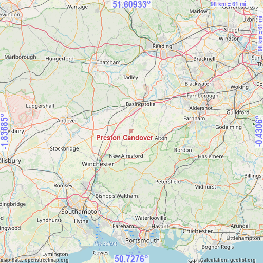
Preston Candover GPS coordinates[2]
51° 10' 14.052" North, 1° 8' 1.392" West
| Map corner | latitude | longitude |
|---|---|---|
| Upper-left | 51.60933°, | -1.83685° |
| Center: | 51.17057°, | -1.13372° |
| Lower-right: | 50.7276°, | -0.4306° |
| Map W x H: | 98×98 km | = 60.9×60.9mi |
| max Lat: | 60.39635° ⇑87.5% North |
| Preston Candover: | 51.17057° |
| min Lat: | ⇓12.5% South 34.60088° |
| min Long | Preston Candove | max Long |
| -7.64133° | -1.13372° | 32.95536° |
| W 64.1%⇐ | ⇒35.9% E |
Elevation
Elevation of Preston Candover is 102 m = 335 ft, and this is 29.1 m = 95 ft above average elevation for this country.
| Max E: |
515 m = 1690 ft | 26.8% |
| Preston Candover | 102 m 335 ft | |
| Avg. | 72.9 m = 239 ft | |
Min E: |
-30 m = -98 ft | 73.2% |
See also: United Kingdom elevation on elevation.city.
Geographical zone
Preston Candover is located in North temperate zone (between Tropic of Cancer and the Arctic Circle). Distance of this North polar circle is 1711.5 km =1063.5 mi to North.| Distance of | km | miles | from Preston Candover |
|---|---|---|---|
| North Pole | 4317.4 | 2682.7 | to North |
| Arctic Circle | 1711.5 | 1063.5 | to North |
| Tropic Cancer | 3083.7 | 1916.1 | to South |
| Equator | 5689.6 | 3535.4 | to South |


Nearby cities:
15 places around Preston Candover: (largest is in red/bold)
• Alton
11.3 km =7 mi,  102°
102°
• Barton Stacey
17.1 km =10.6 mi,  268°
268°
• Basingstoke
10.7 km =6.6 mi,  17°
17°
• Bentworth
6 km =3.7 mi,  105°
105°
• Four Marks
9.2 km =5.7 mi,  140°
140°
• Kings Worthy
14.6 km =9.1 mi,  231°
231°
• Long Sutton
14.4 km =8.9 mi,  67°
67°
• New Alresford
9.7 km =6 mi,  195°
195°
• North Waltham
6.4 km =4 mi,  317°
317°
• Odiham
16.4 km =10.2 mi,  55°
55°
• Old Basing
12.8 km =8 mi,  33°
33°
• Overton
12.1 km =7.5 mi,  312°
312°
• Selborne
15.9 km =9.9 mi,  121°
121°
• Sherborne St John
14.1 km =8.8 mi,  5°
5°
• Sutton Scotney
14.3 km =8.9 mi,  262°
262°
Sources, notices
• [Note1] Compared only with cities in United Kingdom existing in our database
• [Src1] Map data: © OpenStreetMap contributors (CC-BY-SA)
• [Src2] Other city data from geonames.org with taken over terms of usage.
• [Src3] Geographical zone / Annual Mean Temperature by Robert A. Rohde @ Wikipedia
