Pen-clawdd geodata
Pen-clawdd (Wales) is a populated place; located in United Kingdom in Europe/London (GMT+1) time zone. With population of 1,935 people, there are 2673 cities with bigger population in this country. Compared to other cities in United Kingdom, 73.1% of cities are located further ↑North; 89.4% of cities are located further →East and 72.3% of cities have higher elevation than Pen-clawdd. Note1
Administrative division(s):
- Level 1: Wales
- Level 2: City and County of Swansea
- Level 3: Llanrhidian Higher


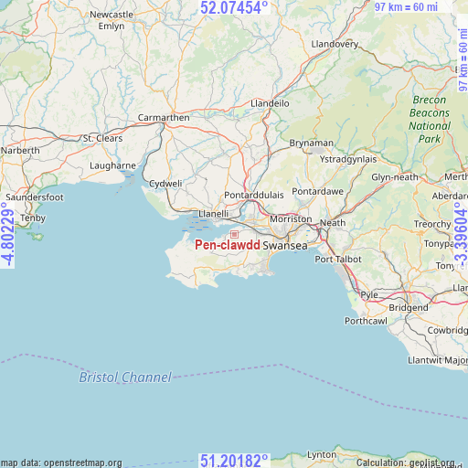
Pen-clawdd GPS coordinates[2]
51° 38' 25.008" North, 4° 5' 57.012" West
| Map corner | latitude | longitude |
|---|---|---|
| Upper-left | 52.07454°, | -4.80229° |
| Center: | 51.64028°, | -4.09917° |
| Lower-right: | 51.20182°, | -3.39604° |
| Map W x H: | 97×97 km | = 60.3×60.3mi |
| max Lat: | 60.39635° ⇑73.1% North |
| Pen-clawdd: | 51.64028° |
| min Lat: | ⇓26.9% South 34.60088° |
| min Long | Pen-clawdd | max Long |
| -7.64133° | -4.09917° | 32.95536° |
| W 10.6%⇐ | ⇒89.4% E |
Elevation
Elevation of Pen-clawdd is 30 m = 98 ft, and this is 42.9 m = 141 ft below average elevation for this country.
| Max E: |
515 m = 1690 ft | 72.3% |
| Avg. | 72.9 m = 239 ft | |
| Pen-clawdd | 30 m = 98 ft | |
Min E: |
-30 m = -98 ft | 27.7% |
See also: United Kingdom elevation on elevation.city.
Geographical zone
Pen-clawdd is located in North temperate zone (between Tropic of Cancer and the Arctic Circle). Distance of this North polar circle is 1659.3 km =1031 mi to North.| Distance of | km | miles | from Pen-clawdd |
|---|---|---|---|
| North Pole | 4265.2 | 2650.3 | to North |
| Arctic Circle | 1659.3 | 1031 | to North |
| Tropic Cancer | 3135.9 | 1948.6 | to South |
| Equator | 5741.9 | 3567.9 | to South |


Nearby cities:
15 places around Pen-clawdd: (largest is in red/bold)
• Bishopston
7.8 km =4.8 mi,  153°
153°
• Burry Port
11.3 km =7 mi,  295°
295°
• Crofty
2.2 km =1.4 mi,  252°
252°
• Gorseinon
5.1 km =3.2 mi,  50°
50°
• Grovesend
6.5 km =4 mi,  40°
40°
• Landore
10.9 km =6.8 mi,  87°
87°
• Llanelli
6.3 km =3.9 mi,  316°
316°
• Llanrhidian
6.2 km =3.9 mi,  232°
232°
• Morriston
12.2 km =7.6 mi,  74°
74°
• Pennard
7.2 km =4.5 mi,  173°
173°
• Pontarddulais
9.2 km =5.7 mi,  26°
26°
• Pontlliw
8.3 km =5.2 mi, 47°
• Southgate
7.9 km =4.9 mi,  175°
175°
• Swansea
11 km =6.8 mi,  101°
101°
• Three Crosses
2.8 km =1.7 mi,  117°
117°
Sources, notices
• [Note1] Compared only with cities in United Kingdom existing in our database
• [Src1] Map data: © OpenStreetMap contributors (CC-BY-SA)
• [Src2] Other city data from geonames.org with taken over terms of usage.
• [Src3] Geographical zone / Annual Mean Temperature by Robert A. Rohde @ Wikipedia
