Invergowrie geodata
Invergowrie (Scotland) is a populated place; located in United Kingdom in Europe/London (GMT+1) time zone. With population of 1,770 people, there are 2795 cities with bigger population in this country. Compared to other cities in United Kingdom, 96.6% of cities are located further ↓South; 76.5% of cities are located further →East and 82% of cities have higher elevation than Invergowrie. Note1


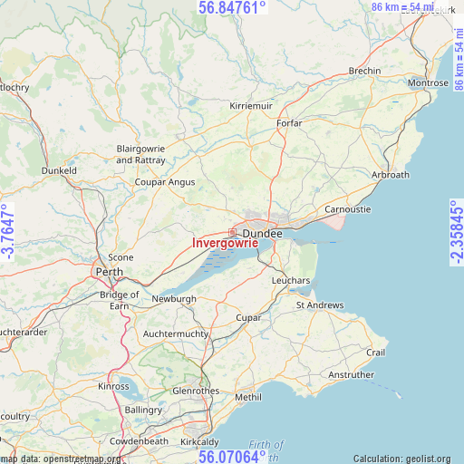
Invergowrie GPS coordinates[2]
56° 27' 39.996" North, 3° 3' 41.688" West
| Map corner | latitude | longitude |
|---|---|---|
| Upper-left | 56.84761°, | -3.7647° |
| Center: | 56.46111°, | -3.06158° |
| Lower-right: | 56.07064°, | -2.35845° |
| Map W x H: | 86.4×86.4 km | = 53.7×53.7mi |
| max Lat: | 60.39635° ⇑3.4% North |
| Invergowrie: | 56.46111° |
| min Lat: | ⇓96.6% South 34.60088° |
| min Long | Invergowrie | max Long |
| -7.64133° | -3.06158° | 32.95536° |
| W 23.5%⇐ | ⇒76.5% E |
Elevation
Elevation of Invergowrie is 19 m = 62 ft, and this is 53.9 m = 177 ft below average elevation for this country.
| Max E: |
515 m = 1690 ft | 82% |
| Avg. | 72.9 m = 239 ft | |
| Invergowrie | 19 m = 62 ft | |
Min E: |
-30 m = -98 ft | 18% |
See also: United Kingdom elevation on elevation.city.
Geographical zone
Invergowrie is located in North temperate zone (between Tropic of Cancer and the Arctic Circle). Distance of this North polar circle is 1123.3 km =698 mi to North.| Distance of | km | miles | from Invergowrie |
|---|---|---|---|
| North Pole | 3729.2 | 2317.2 | to North |
| Arctic Circle | 1123.3 | 698 | to North |
| Tropic Cancer | 3672 | 2281.7 | to South |
| Equator | 6277.9 | 3900.9 | to South |


Nearby cities:
15 places around Invergowrie: (largest is in red/bold)
• Balmullo
12.4 km =7.7 mi,  139°
139°
• Dundee
5.4 km =3.4 mi,  80°
80°
• Errol
12 km =7.5 mi,  230°
230°
• Gauldry
7 km =4.3 mi,  153°
153°
• Guardbridge
15 km =9.3 mi,  134°
134°
• Inchture
6.9 km =4.3 mi,  255°
255°
• Leuchars
14.1 km =8.8 mi, 128°
• Liff
3.1 km =1.9 mi,  331°
331°
• Longforgan
3.3 km =2.1 mi, 262°
• Monifieth
15.2 km =9.4 mi, 81°
• Muirhead
4.3 km =2.7 mi,  355°
355°
• Newport-on-Tay
8.1 km =5 mi,  107°
107°
• Newtyle
12 km =7.5 mi, 334°
• Tayport
11.3 km =7 mi,  97°
97°
• Wellbank
14.2 km =8.8 mi,  60°
60°
Sources, notices
• [Note1] Compared only with cities in United Kingdom existing in our database
• [Src1] Map data: © OpenStreetMap contributors (CC-BY-SA)
• [Src2] Other city data from geonames.org with taken over terms of usage.
• [Src3] Geographical zone / Annual Mean Temperature by Robert A. Rohde @ Wikipedia
