Hugh Town geodata
Hugh Town (England) is a populated place; located in United Kingdom in Europe/London (GMT+0) time zone. With population of 1,068 people, there are 3545 cities with bigger population in this country. Compared to other cities in United Kingdom, 100% of cities are located further ↑North; 98.9% of cities are located further →East and 91.2% of cities have higher elevation than Hugh Town. Note1


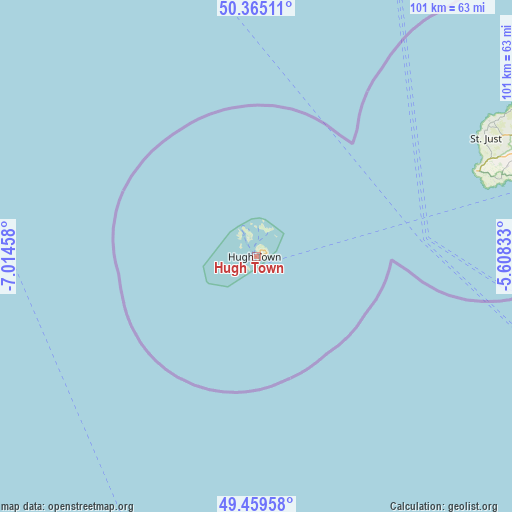
Hugh Town GPS coordinates[2]
49° 54' 52.092" North, 6° 18' 41.22" West
| Map corner | latitude | longitude |
|---|---|---|
| Upper-left | 50.36511°, | -7.01458° |
| Center: | 49.91447°, | -6.31145° |
| Lower-right: | 49.45958°, | -5.60833° |
| Map W x H: | 100.7×100.7 km | = 62.6×62.6mi |
| max Lat: | 60.39635° ⇑100% North |
| Hugh Town: | 49.91447° |
| min Lat: | ⇓0% South 34.60088° |
| min Long | Hugh Town | max Long |
| -7.64133° | -6.31145° | 32.95536° |
| W 1.1%⇐ | ⇒98.9% E |
Elevation
Elevation of Hugh Town is 11 m = 36 ft, and this is 61.9 m = 203 ft below average elevation for this country.
| Max E: |
515 m = 1690 ft | 91.2% |
| Avg. | 72.9 m = 239 ft | |
| Hugh Town | 11 m = 36 ft | |
Min E: |
-30 m = -98 ft | 8.8% |
See also: United Kingdom elevation on elevation.city.
Geographical zone
Hugh Town is located in North temperate zone (between Tropic of Cancer and the Arctic Circle). Distance of this North polar circle is 1851.2 km =1150.3 mi to North.| Distance of | km | miles | from Hugh Town |
|---|---|---|---|
| North Pole | 4457.1 | 2769.5 | to North |
| Arctic Circle | 1851.2 | 1150.3 | to North |
| Tropic Cancer | 2944 | 1829.3 | to South |
| Equator | 5550 | 3448.6 | to South |


Nearby cities:
15 places around Hugh Town: (largest is in red/bold)
• Germoe
70.3 km =43.7 mi,  71°
71°
• Hayle
70.3 km =43.7 mi,  64°
64°
• Helston
77.3 km =48 mi, 74°
• Isles of Scilly
1.5 km =0.9 mi,  37°
37°
• Madron
58.6 km =36.4 mi, 65°
• Marazion
64.2 km =39.9 mi, 68°
• Mousehole
58.3 km =36.2 mi, 71°
• Penzance
59.8 km =37.2 mi, 67°
• Porthleven
73.7 km =45.8 mi, 74°
• Sennen
47.2 km =29.3 mi, 67°
• St Ives
67.3 km =41.8 mi, 60°
• St Just
50.7 km =31.5 mi, 62°
• St Mary's
1.2 km =0.7 mi,  75°
75°
• St. Buryan
52.4 km =32.6 mi, 70°
• Uny Lelant
69 km =42.9 mi, 64°
Sources, notices
• [Note1] Compared only with cities in United Kingdom existing in our database
• [Src1] Map data: © OpenStreetMap contributors (CC-BY-SA)
• [Src2] Other city data from geonames.org with taken over terms of usage.
• [Src3] Geographical zone / Annual Mean Temperature by Robert A. Rohde @ Wikipedia
