Blaenau-Ffestiniog geodata
Blaenau-Ffestiniog (Wales) is a populated place; located in United Kingdom in Europe/London (GMT+1) time zone. With population of 4,005 people, there are 1839 cities with bigger population in this country. Compared to other cities in United Kingdom, 60.6% of cities are located further ↓South; 87.4% of cities are located further →East and 98.4% of cities have lower elevation than Blaenau-Ffestiniog. Note1


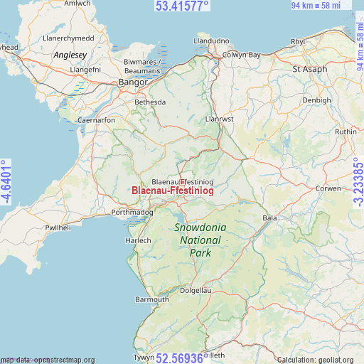
Blaenau-Ffestiniog GPS coordinates[2]
52° 59' 40.704" North, 3° 56' 13.092" West
| Map corner | latitude | longitude |
|---|---|---|
| Upper-left | 53.41577°, | -4.6401° |
| Center: | 52.99464°, | -3.93697° |
| Lower-right: | 52.56936°, | -3.23385° |
| Map W x H: | 94.1×94.1 km | = 58.5×58.5mi |
| max Lat: | 60.39635° ⇑39.4% North |
| Blaenau-Ffestiniog: | 52.99464° |
| min Lat: | ⇓60.6% South 34.60088° |
| min Long | Blaenau-Ffestin | max Long |
| -7.64133° | -3.93697° | 32.95536° |
| W 12.6%⇐ | ⇒87.4% E |
Elevation
Elevation of Blaenau-Ffestiniog is 231 m = 758 ft, and this is 158.1 m = 519 ft above average elevation for this country.
| Max E: |
515 m = 1690 ft | 1.6% |
| Blaenau-Ffestiniog | 231 m 758 ft | |
| Avg. | 72.9 m = 239 ft | |
Min E: |
-30 m = -98 ft | 98.4% |
See also: United Kingdom elevation on elevation.city.
Geographical zone
Blaenau-Ffestiniog is located in North temperate zone (between Tropic of Cancer and the Arctic Circle). Distance of this North polar circle is 1508.7 km =937.5 mi to North.| Distance of | km | miles | from Blaenau-Ffestiniog |
|---|---|---|---|
| North Pole | 4114.6 | 2556.7 | to North |
| Arctic Circle | 1508.7 | 937.5 | to North |
| Tropic Cancer | 3286.5 | 2042.1 | to South |
| Equator | 5892.5 | 3661.4 | to South |


Nearby cities:
15 places around Blaenau-Ffestiniog: (largest is in red/bold)
• Bethesda
22.3 km =13.9 mi,  338°
338°
• Betws-y-Coed
14.1 km =8.8 mi,  38°
38°
• Criccieth
21.6 km =13.4 mi,  247°
247°
• Deiniolen
21.5 km =13.4 mi,  322°
322°
• Ffestiniog
3.9 km =2.4 mi,  175°
175°
• Harlech
18.9 km =11.7 mi,  217°
217°
• Llan Ffestiniog
4.2 km =2.6 mi,  173°
173°
• Llanberis
18.8 km =11.7 mi, 316°
• Llanfair
20.6 km =12.8 mi, 215°
• Llanrwst
18.8 km =11.7 mi,  30°
30°
• Maentwrog
6.4 km =4 mi,  212°
212°
• Penrhyndeudraeth
11 km =6.8 mi,  231°
231°
• Porthmadog
14.9 km =9.3 mi,  240°
240°
• Trawsfynydd
10.3 km =6.4 mi, 174°
• Trefriw
18.9 km =11.7 mi,  23°
23°
Sources, notices
• [Note1] Compared only with cities in United Kingdom existing in our database
• [Src1] Map data: © OpenStreetMap contributors (CC-BY-SA)
• [Src2] Other city data from geonames.org with taken over terms of usage.
• [Src3] Geographical zone / Annual Mean Temperature by Robert A. Rohde @ Wikipedia
