Telavi geodata
Telavi (Kakheti) is a seat of a first-order administrative division; located in Georgia in Asia/Tbilisi (GMT+4) time zone. With population of 21,800 people, there are 14 cities with bigger population in this country. Compared to other cities in Georgia, 58.1% of cities are located further ↑North; 94% of cities are located further ←West and 64.1% of cities have lower elevation than Telavi. Note1


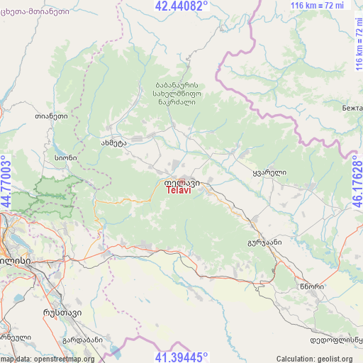
Telavi GPS coordinates[2]
41° 55' 11.208" North, 45° 28' 23.34" East
| Map corner | latitude | longitude |
|---|---|---|
| Upper-left | 42.44082°, | 44.77003° |
| Center: | 41.91978°, | 45.47315° |
| Lower-right: | 41.39445°, | 46.17628° |
| Map W x H: | 116.3×116.3 km | = 72.3×72.3mi |
| max Lat: | 43.38111° ⇑58.1% North |
| Telavi: | 41.91978° |
| min Lat: | ⇓41.9% South 41.21725° |
| min Long | Telavi | max Long |
| 40.07944° | 45.47315° | 46.27667° |
| W 94%⇐ | ⇒6% E |
Elevation
Elevation of Telavi is 722 m = 2369 ft, and this is 143.2 m = 470 ft above average elevation for this country.
| Max E: |
2223 m = 7293 ft | 35.9% |
| Telavi | 722 m 2369 ft | |
| Avg. | 578.8 m = 1899 ft | |
Min E: |
1 m = 3 ft | 64.1% |
See also: Georgia elevation on elevation.city.
Geographical zone
Telavi is located in North temperate zone (between Tropic of Cancer and the Arctic Circle). Distance of this Northern Tropic circle is 2055.1 km =1277 mi to South.| Distance of | km | miles | from Telavi |
|---|---|---|---|
| North Pole | 5346 | 3321.8 | to North |
| Arctic Circle | 2740.1 | 1702.6 | to North |
| Tropic Cancer | 2055.1 | 1277 | to South |
| Equator | 4661 | 2896.2 | to South |


Nearby cities:
15 places around Telavi: (largest is in red/bold)
• Akhmet’a
25.2 km =15.7 mi,  299°
299°
• Bagdadi
47.8 km =29.7 mi,  103°
103°
• Didi Lilo
46.8 km =29.1 mi,  244°
244°
• Gardabani
60 km =37.3 mi,  211°
211°
• Gurjaani
33.5 km =20.8 mi,  125°
125°
• Qvareli
28.7 km =17.8 mi,  82°
82°
• Rust’avi
57.3 km =35.6 mi,  224°
224°
• Sagarejo
23.8 km =14.8 mi, 209°
• Sighnaghi
49.9 km =31 mi, 131°
• Tbilisi
58.6 km =36.4 mi, 244°
• Tsinandali
8.6 km =5.3 mi,  110°
110°
• Tsnori
52.9 km =32.9 mi, 128°
• T’ianet’i
47 km =29.2 mi, 296°
• Zahesi
60.5 km =37.6 mi,  259°
259°
• Zhinvali
62.5 km =38.8 mi,  292°
292°
Sources, notices
• [Note1] Compared only with cities in Georgia existing in our database
• [Src1] Map data: © OpenStreetMap contributors (CC-BY-SA)
• [Src2] Other city data from geonames.org with taken over terms of usage.
• [Src3] Geographical zone / Annual Mean Temperature by Robert A. Rohde @ Wikipedia
