Sighnaghi geodata
Sighnaghi (Kakheti) is a populated place; located in Georgia in Asia/Tbilisi (GMT+4) time zone. With population of 1,923 people, there are 86 cities with bigger population in this country. Compared to other cities in Georgia, 86.3% of cities are located further ↑North; 97.4% of cities are located further ←West and 70.1% of cities have lower elevation than Sighnaghi. Note1


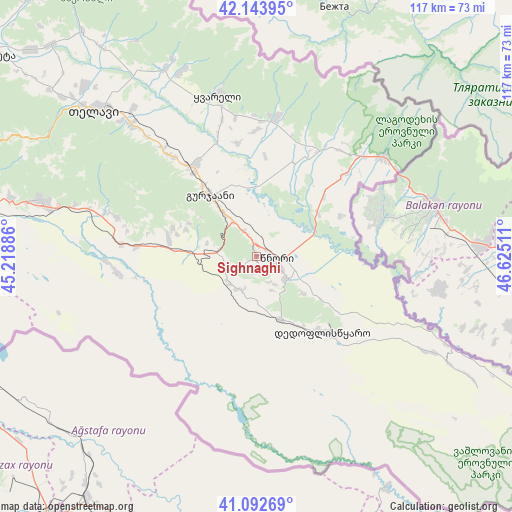
Sighnaghi GPS coordinates[2]
41° 37' 13.656" North, 45° 55' 19.128" East
| Map corner | latitude | longitude |
|---|---|---|
| Upper-left | 42.14395°, | 45.21886° |
| Center: | 41.62046°, | 45.92198° |
| Lower-right: | 41.09269°, | 46.62511° |
| Map W x H: | 116.9×116.9 km | = 72.6×72.6mi |
| max Lat: | 43.38111° ⇑86.3% North |
| Sighnaghi: | 41.62046° |
| min Lat: | ⇓13.7% South 41.21725° |
| min Long | Sighnaghi | max Long |
| 40.07944° | 45.92198° | 46.27667° |
| W 97.4%⇐ | ⇒2.6% E |
Elevation
Elevation of Sighnaghi is 779 m = 2556 ft, and this is 200.2 m = 657 ft above average elevation for this country.
| Max E: |
2223 m = 7293 ft | 29.9% |
| Sighnaghi | 779 m 2556 ft | |
| Avg. | 578.8 m = 1899 ft | |
Min E: |
1 m = 3 ft | 70.1% |
See also: Georgia elevation on elevation.city.
Geographical zone
Sighnaghi is located in North temperate zone (between Tropic of Cancer and the Arctic Circle). Distance of this Northern Tropic circle is 2021.8 km =1256.3 mi to South.| Distance of | km | miles | from Sighnaghi |
|---|---|---|---|
| North Pole | 5379.3 | 3342.5 | to North |
| Arctic Circle | 2773.4 | 1723.3 | to North |
| Tropic Cancer | 2021.8 | 1256.3 | to South |
| Equator | 4627.8 | 2875.6 | to South |


Nearby cities:
15 places around Sighnaghi: (largest is in red/bold)
• Akhmet’a
74.8 km =46.5 mi,  307°
307°
• Bagdadi
23.7 km =14.7 mi,  22°
22°
• Didi Lilo
80.5 km =50 mi,  279°
279°
• Gardabani
71.3 km =44.3 mi,  255°
255°
• Gurjaani
16.9 km =10.5 mi,  323°
323°
• Lagodekhi
37.3 km =23.2 mi,  52°
52°
• Marneuli
94 km =58.4 mi, 260°
• Qvareli
38.2 km =23.7 mi,  346°
346°
• Rust’avi
77.6 km =48.2 mi, 264°
• Sagarejo
50.6 km =31.4 mi, 284°
• Tbilisi
90.8 km =56.4 mi, 275°
• Telavi
49.9 km =31 mi, 311°
• Tsinandali
42 km =26.1 mi, 316°
• Tsnori
3.9 km =2.4 mi,  89°
89°
• T’ianet’i
96.1 km =59.7 mi,  304°
304°
Sources, notices
• [Note1] Compared only with cities in Georgia existing in our database
• [Src1] Map data: © OpenStreetMap contributors (CC-BY-SA)
• [Src2] Other city data from geonames.org with taken over terms of usage.
• [Src3] Geographical zone / Annual Mean Temperature by Robert A. Rohde @ Wikipedia
