Sagarejo geodata
Sagarejo (Kakheti) is a populated place; located in Georgia in Asia/Tbilisi (GMT+4) time zone. With population of 12,173 people, there are 27 cities with bigger population in this country. Compared to other cities in Georgia, 71.8% of cities are located further ↑North; 93.2% of cities are located further ←West and 67.5% of cities have lower elevation than Sagarejo. Note1


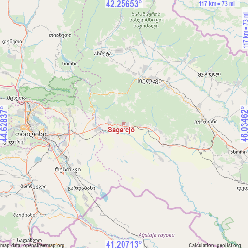
Sagarejo GPS coordinates[2]
41° 44' 2.292" North, 45° 19' 53.364" East
| Map corner | latitude | longitude |
|---|---|---|
| Upper-left | 42.25653°, | 44.62837° |
| Center: | 41.73397°, | 45.33149° |
| Lower-right: | 41.20713°, | 46.03462° |
| Map W x H: | 116.7×116.7 km | = 72.5×72.5mi |
| max Lat: | 43.38111° ⇑71.8% North |
| Sagarejo: | 41.73397° |
| min Lat: | ⇓28.2% South 41.21725° |
| min Long | Sagarejo | max Long |
| 40.07944° | 45.33149° | 46.27667° |
| W 93.2%⇐ | ⇒6.8% E |
Elevation
Elevation of Sagarejo is 748 m = 2454 ft, and this is 169.2 m = 555 ft above average elevation for this country.
| Max E: |
2223 m = 7293 ft | 32.5% |
| Sagarejo | 748 m 2454 ft | |
| Avg. | 578.8 m = 1899 ft | |
Min E: |
1 m = 3 ft | 67.5% |
See also: Georgia elevation on elevation.city.
Geographical zone
Sagarejo is located in North temperate zone (between Tropic of Cancer and the Arctic Circle). Distance of this Northern Tropic circle is 2034.5 km =1264.2 mi to South.| Distance of | km | miles | from Sagarejo |
|---|---|---|---|
| North Pole | 5366.7 | 3334.7 | to North |
| Arctic Circle | 2760.8 | 1715.5 | to North |
| Tropic Cancer | 2034.5 | 1264.2 | to South |
| Equator | 4640.4 | 2883.4 | to South |


Nearby cities:
15 places around Sagarejo: (largest is in red/bold)
• Akhmet’a
34.6 km =21.5 mi,  342°
342°
• Didi Lilo
30.4 km =18.9 mi,  270°
270°
• Gardabani
36.3 km =22.6 mi,  213°
213°
• Gurjaani
39 km =24.2 mi,  88°
88°
• Marneuli
52.1 km =32.4 mi,  236°
236°
• Mtskheta
52.3 km =32.5 mi,  283°
283°
• Qvareli
47.1 km =29.3 mi,  58°
58°
• Rust’avi
34.8 km =21.6 mi,  233°
233°
• Sighnaghi
50.6 km =31.4 mi,  104°
104°
• Tbilisi
41.6 km =25.8 mi,  263°
263°
• Telavi
23.8 km =14.8 mi,  29°
29°
• Tsinandali
26.6 km =16.5 mi,  48°
48°
• Tsqnet’i
52.7 km =32.7 mi, 265°
• T’ianet’i
51.6 km =32.1 mi,  323°
323°
• Zahesi
49 km =30.4 mi, 281°
Sources, notices
• [Note1] Compared only with cities in Georgia existing in our database
• [Src1] Map data: © OpenStreetMap contributors (CC-BY-SA)
• [Src2] Other city data from geonames.org with taken over terms of usage.
• [Src3] Geographical zone / Annual Mean Temperature by Robert A. Rohde @ Wikipedia
