Tsnori geodata
Tsnori (Kakheti) is a populated place; located in Georgia in Asia/Tbilisi (GMT+4) time zone. With population of 6,609 people, there are 46 cities with bigger population in this country. Compared to other cities in Georgia, 85.5% of cities are located further ↑North; 98.3% of cities are located further ←West and 62.4% of cities have higher elevation than Tsnori. Note1


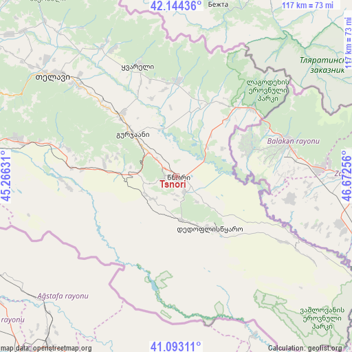
Tsnori GPS coordinates[2]
41° 37' 15.168" North, 45° 58' 9.948" East
| Map corner | latitude | longitude |
|---|---|---|
| Upper-left | 42.14436°, | 45.26631° |
| Center: | 41.62088°, | 45.96943° |
| Lower-right: | 41.09311°, | 46.67256° |
| Map W x H: | 116.9×116.9 km | = 72.6×72.6mi |
| max Lat: | 43.38111° ⇑85.5% North |
| Tsnori: | 41.62088° |
| min Lat: | ⇓14.5% South 41.21725° |
| min Long | Tsnori | max Long |
| 40.07944° | 45.96943° | 46.27667° |
| W 98.3%⇐ | ⇒1.7% E |
Elevation
Elevation of Tsnori is 296 m = 971 ft, and this is 282.8 m = 928 ft below average elevation for this country.
| Max E: |
2223 m = 7293 ft | 62.4% |
| Avg. | 578.8 m = 1899 ft | |
| Tsnori | 296 m = 971 ft | |
Min E: |
1 m = 3 ft | 37.6% |
See also: Georgia elevation on elevation.city.
Geographical zone
Tsnori is located in North temperate zone (between Tropic of Cancer and the Arctic Circle). Distance of this Northern Tropic circle is 2021.9 km =1256.4 mi to South.| Distance of | km | miles | from Tsnori |
|---|---|---|---|
| North Pole | 5379.3 | 3342.5 | to North |
| Arctic Circle | 2773.4 | 1723.3 | to North |
| Tropic Cancer | 2021.9 | 1256.4 | to South |
| Equator | 4627.8 | 2875.6 | to South |


Nearby cities:
15 places around Tsnori: (largest is in red/bold)
• Akhmet’a
77.9 km =48.4 mi,  305°
305°
• Bagdadi
22.4 km =13.9 mi,  13°
13°
• Didi Lilo
84.4 km =52.4 mi,  278°
278°
• Gardabani
75.1 km =46.7 mi,  256°
256°
• Gurjaani
19.5 km =12.1 mi, 314°
• Lagodekhi
34.3 km =21.3 mi,  48°
48°
• Marneuli
97.9 km =60.8 mi, 260°
• Qvareli
39.2 km =24.4 mi,  341°
341°
• Rust’avi
81.6 km =50.7 mi, 264°
• Sagarejo
54.5 km =33.9 mi, 283°
• Sighnaghi
3.9 km =2.4 mi,  269°
269°
• Tbilisi
94.7 km =58.8 mi, 274°
• Telavi
52.9 km =32.9 mi, 308°
• Tsinandali
44.8 km =27.8 mi, 312°
• T’ianet’i
99.3 km =61.7 mi,  303°
303°
Sources, notices
• [Note1] Compared only with cities in Georgia existing in our database
• [Src1] Map data: © OpenStreetMap contributors (CC-BY-SA)
• [Src2] Other city data from geonames.org with taken over terms of usage.
• [Src3] Geographical zone / Annual Mean Temperature by Robert A. Rohde @ Wikipedia
