Corfu geodata
Corfu (Ionian Islands) is a seat of a first-order administrative division; located in Greece in Europe/Athens (GMT+3) time zone. With population of 27,003 people, there are 70 cities with bigger population in this country. Compared to other cities in Greece, 60.4% of cities are located further ↓South; 97.9% of cities are located further →East and 82.6% of cities have higher elevation than Corfu. Note1


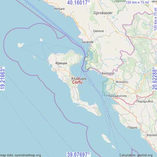
Corfu GPS coordinates[2]
39° 37' 14.484" North, 19° 55' 11.1" East
| Map corner | latitude | longitude |
|---|---|---|
| Upper-left | 40.16017°, | 19.21663° |
| Center: | 39.62069°, | 19.91975° |
| Lower-right: | 39.07697°, | 20.62288° |
| Map W x H: | 120.4×120.4 km | = 74.8×74.8mi |
| max Lat: | 41.72048° ⇑39.6% North |
| Corfu: | 39.62069° |
| min Lat: | ⇓60.4% South 34.8346° |
| min Long | Corfu | max Long |
| 19.40494° | 19.91975° | 29.59361° |
| W 2.1%⇐ | ⇒97.9% E |
Elevation
Elevation of Corfu is 15 m = 49 ft, and this is 153.9 m = 505 ft below average elevation for this country.
| Max E: |
1439 m = 4721 ft | 82.6% |
| Avg. | 168.9 m = 554 ft | |
| Corfu | 15 m = 49 ft | |
Min E: |
0 m = 0 ft | 17.4% |
See also: Greece elevation on elevation.city.
Geographical zone
Corfu is located in North temperate zone (between Tropic of Cancer and the Arctic Circle). Distance of this Northern Tropic circle is 1799.5 km =1118.2 mi to South.| Distance of | km | miles | from Corfu |
|---|---|---|---|
| North Pole | 5601.7 | 3480.7 | to North |
| Arctic Circle | 2995.8 | 1861.5 | to North |
| Tropic Cancer | 1799.5 | 1118.2 | to South |
| Equator | 4405.4 | 2737.4 | to South |


Nearby cities:
15 places around Corfu: (largest is in red/bold)
• Alepoú
2.1 km =1.3 mi,  255°
255°
• Chrysiída
3.9 km =2.4 mi,  209°
209°
• Gastoúri
6.9 km =4.3 mi,  195°
195°
• Gouviá
7.5 km =4.7 mi,  298°
298°
• Kanáli
2.9 km =1.8 mi,  234°
234°
• Kastanéa
4.3 km =2.7 mi,  224°
224°
• Kompítsion
4.8 km =3 mi,  249°
249°
• Kontokáli
6.4 km =4 mi,  294°
294°
• Kynopiástes
6.6 km =4.1 mi, 207°
• Kyrá Chrysikoú
7.6 km =4.7 mi, 286°
• Perama
4.3 km =2.7 mi,  188°
188°
• Potamós
3.6 km =2.2 mi,  276°
276°
• Virós
5.2 km =3.2 mi, 217°
• Áfra
5.3 km =3.3 mi,  271°
271°
• Ágios Ioánnis
6.2 km =3.9 mi, 264°
In other languages:
- In Spanish: Corfú
- In France: Corfou
- In German: Korfu
- In Italian: Corfù
- In Russian: Корфу, Керкира
- In Chinese: 克基拉市
Sources, notices
• [Note1] Compared only with cities in Greece existing in our database
• [Src1] Map data: © OpenStreetMap contributors (CC-BY-SA)
• [Src2] Other city data from geonames.org with taken over terms of usage.
• [Src3] Geographical zone / Annual Mean Temperature by Robert A. Rohde @ Wikipedia
