Kallitechnoúpoli geodata
Kallitechnoúpoli (Attica) is a populated place; located in Greece in Europe/Athens (GMT+3) time zone. With population of 923 people, there are 1100 cities with bigger population in this country. Compared to other cities in Greece, 72.5% of cities are located further ↑North; 77.5% of cities are located further ←West and 73.1% of cities have lower elevation than Kallitechnoúpoli. Note1
Administrative division(s):
- Level 1: Attica
- Level 2: Nomarchía Anatolikís Attikís
- Level 3: Dimos Rafina-Pikermi


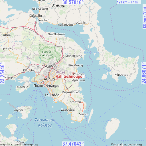
Kallitechnoúpoli GPS coordinates[2]
38° 1' 35.004" North, 23° 57' 27.288" East
| Map corner | latitude | longitude |
|---|---|---|
| Upper-left | 38.57816°, | 23.25446° |
| Center: | 38.02639°, | 23.95758° |
| Lower-right: | 37.47043°, | 24.66071° |
| Map W x H: | 123.2×123.2 km | = 76.6×76.6mi |
| max Lat: | 41.72048° ⇑72.5% North |
| Kallitechnoúpoli: | 38.02639° |
| min Lat: | ⇓27.5% South 34.8346° |
| min Long | Kallitechnoúpo | max Long |
| 19.40494° | 23.95758° | 29.59361° |
| W 77.5%⇐ | ⇒22.5% E |
Elevation
Elevation of Kallitechnoúpoli is 190 m = 623 ft, and this is 21.1 m = 69 ft above average elevation for this country.
| Max E: |
1439 m = 4721 ft | 26.9% |
| Kallitechnoúpoli | 190 m 623 ft | |
| Avg. | 168.9 m = 554 ft | |
Min E: |
0 m = 0 ft | 73.1% |
See also: Greece elevation on elevation.city.
Geographical zone
Kallitechnoúpoli is located in North temperate zone (between Tropic of Cancer and the Arctic Circle). Distance of this Northern Tropic circle is 1622.2 km =1008 mi to South.| Distance of | km | miles | from Kallitechnoúpoli |
|---|---|---|---|
| North Pole | 5778.9 | 3590.8 | to North |
| Arctic Circle | 3173 | 1971.6 | to North |
| Tropic Cancer | 1622.2 | 1008 | to South |
| Equator | 4228.1 | 2627.2 | to South |


Nearby cities:
15 places around Kallitechnoúpoli: (largest is in red/bold)
• Agia Kyriakií Spáton
4.1 km =2.5 mi,  154°
154°
• Anthoúsa
7.1 km =4.4 mi,  269°
269°
• Argithéa
8.5 km =5.3 mi,  227°
227°
• Artémida
7.4 km =4.6 mi, 152°
• Christoúpoli
6.4 km =4 mi,  213°
213°
• Dhráfi
4.4 km =2.7 mi, 266°
• Dióni
2.2 km =1.4 mi,  260°
260°
• Neos Voutzás
2.5 km =1.6 mi,  43°
43°
• Neápoli Spáton
7 km =4.3 mi,  164°
164°
• Néa Mákri
7 km =4.3 mi,  13°
13°
• Pallíni
6.9 km =4.3 mi,  250°
250°
• Pentéli
8.4 km =5.2 mi,  288°
288°
• Pikérmi
3.1 km =1.9 mi, 208°
• Rafína
4.3 km =2.7 mi,  102°
102°
• Spáta
8.1 km =5 mi, 207°
Sources, notices
• [Note1] Compared only with cities in Greece existing in our database
• [Src1] Map data: © OpenStreetMap contributors (CC-BY-SA)
• [Src2] Other city data from geonames.org with taken over terms of usage.
• [Src3] Geographical zone / Annual Mean Temperature by Robert A. Rohde @ Wikipedia
