Vlachokerasiá geodata
Vlachokerasiá (Peloponnese) is a populated place; located in Greece in Europe/Athens (GMT+3) time zone. With population of 773 people, there are 1301 cities with bigger population in this country. Compared to other cities in Greece, 87.2% of cities are located further ↑North; 63.4% of cities are located further →East and 99.3% of cities have lower elevation than Vlachokerasiá. Note1


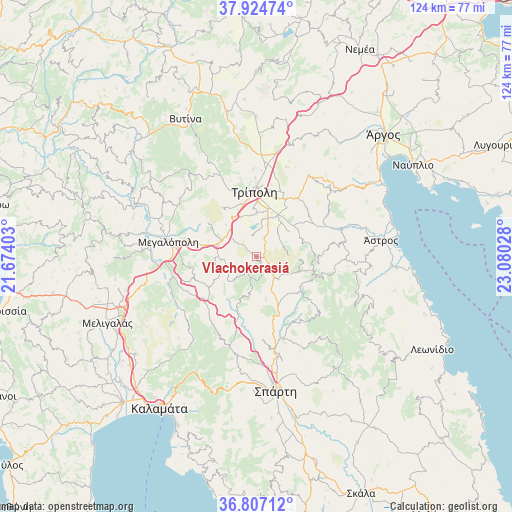
Vlachokerasiá GPS coordinates[2]
37° 22' 4.836" North, 22° 22' 37.74" East
| Map corner | latitude | longitude |
|---|---|---|
| Upper-left | 37.92474°, | 21.67403° |
| Center: | 37.36801°, | 22.37715° |
| Lower-right: | 36.80712°, | 23.08028° |
| Map W x H: | 124.3×124.3 km | = 77.2×77.2mi |
| max Lat: | 41.72048° ⇑87.2% North |
| Vlachokerasiá: | 37.36801° |
| min Lat: | ⇓12.8% South 34.8346° |
| min Long | Vlachokerasiá | max Long |
| 19.40494° | 22.37715° | 29.59361° |
| W 36.6%⇐ | ⇒63.4% E |
Elevation
Elevation of Vlachokerasiá is 955 m = 3133 ft, and this is 786.1 m = 2579 ft above average elevation for this country.
| Max E: |
1439 m = 4721 ft | 0.7% |
| Vlachokerasiá | 955 m 3133 ft | |
| Avg. | 168.9 m = 554 ft | |
Min E: |
0 m = 0 ft | 99.3% |
See also: Greece elevation on elevation.city.
Geographical zone
Vlachokerasiá is located in North temperate zone (between Tropic of Cancer and the Arctic Circle). Distance of this Northern Tropic circle is 1549 km =962.5 mi to South.| Distance of | km | miles | from Vlachokerasiá |
|---|---|---|---|
| North Pole | 5852.1 | 3636.3 | to North |
| Arctic Circle | 3246.2 | 2017.1 | to North |
| Tropic Cancer | 1549 | 962.5 | to South |
| Equator | 4154.9 | 2581.7 | to South |


Nearby cities:
15 places around Vlachokerasiá: (largest is in red/bold)
• Arfará
37.7 km =23.4 mi,  231°
231°
• Karyés
13.9 km =8.6 mi,  128°
128°
• Kefalári
37.7 km =23.4 mi,  47°
47°
• Kivéri
35.6 km =22.1 mi,  60°
60°
• Korakovoúni
32.8 km =20.4 mi,  93°
93°
• Levídion
35.7 km =22.2 mi,  348°
348°
• Magoúla
32.1 km =19.9 mi,  175°
175°
• Megalópoli
21.1 km =13.1 mi,  280°
280°
• Mýloi
36.3 km =22.6 mi, 55°
• Parálio Ástros
34.8 km =21.6 mi,  81°
81°
• Spárti
33 km =20.5 mi,  171°
171°
• Trípoli
15.7 km =9.8 mi,  0°
0°
• Ágios Andréas
34.3 km =21.3 mi, 94°
• Ágios Pétros
15.6 km =9.7 mi,  106°
106°
• Ástros
30.7 km =19.1 mi, 82°
Sources, notices
• [Note1] Compared only with cities in Greece existing in our database
• [Src1] Map data: © OpenStreetMap contributors (CC-BY-SA)
• [Src2] Other city data from geonames.org with taken over terms of usage.
• [Src3] Geographical zone / Annual Mean Temperature by Robert A. Rohde @ Wikipedia
