Várda geodata
Várda (West Greece) is a populated place; located in Greece in Europe/Athens (GMT+3) time zone. With population of 3,307 people, there are 324 cities with bigger population in this country. Compared to other cities in Greece, 72.2% of cities are located further ↑North; 85% of cities are located further →East and 78.7% of cities have higher elevation than Várda. Note1
Administrative division(s):
- Level 1: West Greece
- Level 2: Nomós Ileías
- Level 3: Dimos Andravida-Kyllini


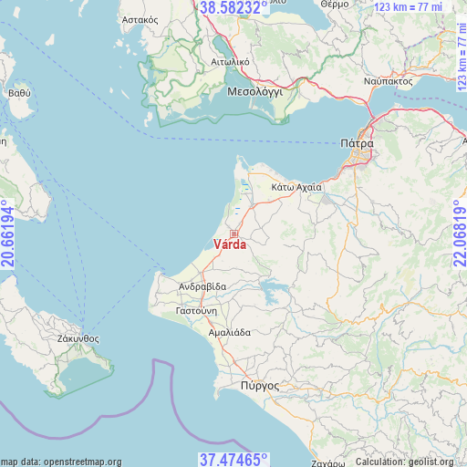
Várda GPS coordinates[2]
38° 1' 50.088" North, 21° 21' 54.216" East
| Map corner | latitude | longitude |
|---|---|---|
| Upper-left | 38.58232°, | 20.66194° |
| Center: | 38.03058°, | 21.36506° |
| Lower-right: | 37.47465°, | 22.06819° |
| Map W x H: | 123.2×123.2 km | = 76.6×76.6mi |
| max Lat: | 41.72048° ⇑72.2% North |
| Várda: | 38.03058° |
| min Lat: | ⇓27.8% South 34.8346° |
| min Long | Várda | max Long |
| 19.40494° | 21.36506° | 29.59361° |
| W 15%⇐ | ⇒85% E |
Elevation
Elevation of Várda is 19 m = 62 ft, and this is 149.9 m = 492 ft below average elevation for this country.
| Max E: |
1439 m = 4721 ft | 78.7% |
| Avg. | 168.9 m = 554 ft | |
| Várda | 19 m = 62 ft | |
Min E: |
0 m = 0 ft | 21.3% |
See also: Greece elevation on elevation.city.
Geographical zone
Várda is located in North temperate zone (between Tropic of Cancer and the Arctic Circle). Distance of this Northern Tropic circle is 1622.7 km =1008.3 mi to South.| Distance of | km | miles | from Várda |
|---|---|---|---|
| North Pole | 5778.5 | 3590.6 | to North |
| Arctic Circle | 3172.6 | 1971.4 | to North |
| Tropic Cancer | 1622.7 | 1008.3 | to South |
| Equator | 4228.6 | 2627.5 | to South |


Nearby cities:
15 places around Várda: (largest is in red/bold)
• Andravída
16.2 km =10.1 mi,  211°
211°
• Chávari
20.3 km =12.6 mi,  175°
175°
• Kavásila
19.3 km =12 mi, 207°
• Lakkopetra
17.6 km =10.9 mi,  26°
26°
• Lechainá
13.8 km =8.6 mi,  218°
218°
• Limnokhórion
15.9 km =9.9 mi,  39°
39°
• Lápas
8.8 km =5.5 mi, 32°
• Manoláda
2.4 km =1.5 mi,  321°
321°
• Metóchi
11 km =6.8 mi,  16°
16°
• Myrsíni
16.6 km =10.3 mi, 222°
• Neochóri
19.6 km =12.2 mi,  226°
226°
• Néa Manoláda
3 km =1.9 mi, 29°
• Synoikismós Chavaríou
19.5 km =12.1 mi,  174°
174°
• Traganón
15.5 km =9.6 mi,  197°
197°
• Íkaros
20.6 km =12.8 mi, 233°
Sources, notices
• [Note1] Compared only with cities in Greece existing in our database
• [Src1] Map data: © OpenStreetMap contributors (CC-BY-SA)
• [Src2] Other city data from geonames.org with taken over terms of usage.
• [Src3] Geographical zone / Annual Mean Temperature by Robert A. Rohde @ Wikipedia
