Skoúrta geodata
Skoúrta (Central Greece) is a populated place; located in Greece in Europe/Athens (GMT+3) time zone. With population of 982 people, there are 1039 cities with bigger population in this country. Compared to other cities in Greece, 67.7% of cities are located further ↑North; 65.6% of cities are located further ←West and 91.3% of cities have lower elevation than Skoúrta. Note1


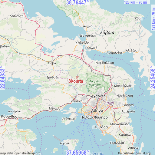
Skoúrta GPS coordinates[2]
38° 12' 50.832" North, 23° 33' 5.22" East
| Map corner | latitude | longitude |
|---|---|---|
| Upper-left | 38.76447°, | 22.84833° |
| Center: | 38.21412°, | 23.55145° |
| Lower-right: | 37.65958°, | 24.25458° |
| Map W x H: | 122.9×122.9 km | = 76.4×76.4mi |
| max Lat: | 41.72048° ⇑67.7% North |
| Skoúrta: | 38.21412° |
| min Lat: | ⇓32.3% South 34.8346° |
| min Long | Skoúrta | max Long |
| 19.40494° | 23.55145° | 29.59361° |
| W 65.6%⇐ | ⇒34.4% E |
Elevation
Elevation of Skoúrta is 547 m = 1795 ft, and this is 378.1 m = 1240 ft above average elevation for this country.
| Max E: |
1439 m = 4721 ft | 8.7% |
| Skoúrta | 547 m 1795 ft | |
| Avg. | 168.9 m = 554 ft | |
Min E: |
0 m = 0 ft | 91.3% |
See also: Greece elevation on elevation.city.
Geographical zone
Skoúrta is located in North temperate zone (between Tropic of Cancer and the Arctic Circle). Distance of this Northern Tropic circle is 1643.1 km =1021 mi to South.| Distance of | km | miles | from Skoúrta |
|---|---|---|---|
| North Pole | 5758.1 | 3577.9 | to North |
| Arctic Circle | 3152.2 | 1958.7 | to North |
| Tropic Cancer | 1643.1 | 1021 | to South |
| Equator | 4249 | 2640.2 | to South |


Nearby cities:
15 places around Skoúrta: (largest is in red/bold)
• Asopía
10.4 km =6.5 mi,  335°
335°
• Asprópyrgos
17.3 km =10.7 mi,  168°
168°
• Avlónas
13.3 km =8.3 mi,  71°
71°
• Dílesi
17.2 km =10.7 mi,  37°
37°
• Fylí
16.1 km =10 mi,  140°
140°
• Kallithea - Moustafádhes
14.6 km =9.1 mi,  317°
317°
• Magoúla
15.2 km =9.4 mi,  190°
190°
• Mándra
17 km =10.6 mi,  195°
195°
• Néa Zoí
15.7 km =9.8 mi, 202°
• Oinófyta
13.3 km =8.3 mi, 35°
• Pláka Dílesi
17.4 km =10.8 mi,  29°
29°
• Schimatári
15.4 km =9.6 mi,  10°
10°
• Sykámino
18.4 km =11.4 mi,  57°
57°
• Árma
16.3 km =10.1 mi, 339°
• Áyios Thomás
7.7 km =4.8 mi, 25°
Sources, notices
• [Note1] Compared only with cities in Greece existing in our database
• [Src1] Map data: © OpenStreetMap contributors (CC-BY-SA)
• [Src2] Other city data from geonames.org with taken over terms of usage.
• [Src3] Geographical zone / Annual Mean Temperature by Robert A. Rohde @ Wikipedia
