Magoúla geodata
Magoúla (Attica) is a populated place; located in Greece in Europe/Athens (GMT+3) time zone. With population of 4,735 people, there are 246 cities with bigger population in this country. Compared to other cities in Greece, 70.7% of cities are located further ↑North; 64.9% of cities are located further ←West and 51.2% of cities have higher elevation than Magoúla. Note1
Administrative division(s):
- Level 1: Attica
- Level 2: Nomarchía Dytikís Attikís
- Level 3: Dimos Elefsina


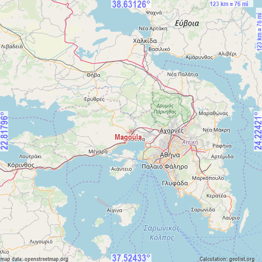
Magoúla GPS coordinates[2]
38° 4' 47.604" North, 23° 31' 15.888" East
| Map corner | latitude | longitude |
|---|---|---|
| Upper-left | 38.63126°, | 22.81796° |
| Center: | 38.07989°, | 23.52108° |
| Lower-right: | 37.52433°, | 24.22421° |
| Map W x H: | 123.1×123.1 km | = 76.5×76.5mi |
| max Lat: | 41.72048° ⇑70.7% North |
| Magoúla: | 38.07989° |
| min Lat: | ⇓29.3% South 34.8346° |
| min Long | Magoúla | max Long |
| 19.40494° | 23.52108° | 29.59361° |
| W 64.9%⇐ | ⇒35.1% E |
Elevation
Elevation of Magoúla is 76 m = 249 ft, and this is 92.9 m = 305 ft below average elevation for this country.
| Max E: |
1439 m = 4721 ft | 51.2% |
| Avg. | 168.9 m = 554 ft | |
| Magoúla | 76 m = 249 ft | |
Min E: |
0 m = 0 ft | 48.8% |
See also: Greece elevation on elevation.city.
Geographical zone
Magoúla is located in North temperate zone (between Tropic of Cancer and the Arctic Circle). Distance of this Northern Tropic circle is 1628.2 km =1011.7 mi to South.| Distance of | km | miles | from Magoúla |
|---|---|---|---|
| North Pole | 5773 | 3587.2 | to North |
| Arctic Circle | 3167.1 | 1967.9 | to North |
| Tropic Cancer | 1628.2 | 1011.7 | to South |
| Equator | 4234.1 | 2630.9 | to South |


Nearby cities:
15 places around Magoúla: (largest is in red/bold)
• Ampelákia
14.4 km =8.9 mi,  177°
177°
• Asprópyrgos
6.4 km =4 mi,  108°
108°
• Chaïdári
14.8 km =9.2 mi,  120°
120°
• Elefsína
4.7 km =2.9 mi,  155°
155°
• Fylí
13.2 km =8.2 mi,  79°
79°
• Lákka Kalogírou
15.2 km =9.4 mi,  231°
231°
• Mándra
2.4 km =1.5 mi, 231°
• Néa Péramos
11.8 km =7.3 mi, 226°
• Néa Zoí
3.3 km =2.1 mi,  276°
276°
• Petroúpolis
15 km =9.3 mi, 106°
• Pérama
13.2 km =8.2 mi, 160°
• Salamína
13 km =8.1 mi,  189°
189°
• Skarmagkás
10.5 km =6.5 mi,  136°
136°
• Skoúrta
15.2 km =9.4 mi,  10°
10°
• Vlycháda
9.4 km =5.8 mi, 231°
Sources, notices
• [Note1] Compared only with cities in Greece existing in our database
• [Src1] Map data: © OpenStreetMap contributors (CC-BY-SA)
• [Src2] Other city data from geonames.org with taken over terms of usage.
• [Src3] Geographical zone / Annual Mean Temperature by Robert A. Rohde @ Wikipedia
