Skiáthos geodata
Skiáthos (Thessaly) is a populated place; located in Greece in Europe/Athens (GMT+3) time zone. With population of 5,187 people, there are 229 cities with bigger population in this country. Compared to other cities in Greece, 51.3% of cities are located further ↑North; 64.4% of cities are located further ←West and 97.4% of cities have higher elevation than Skiáthos. Note1


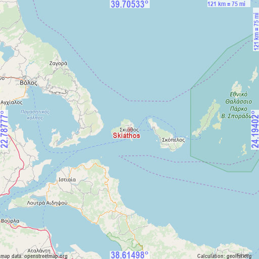
Skiáthos GPS coordinates[2]
39° 9' 44.172" North, 23° 29' 27.204" East
| Map corner | latitude | longitude |
|---|---|---|
| Upper-left | 39.70533°, | 22.78777° |
| Center: | 39.16227°, | 23.49089° |
| Lower-right: | 38.61498°, | 24.19402° |
| Map W x H: | 121.2×121.2 km | = 75.3×75.3mi |
| max Lat: | 41.72048° ⇑51.3% North |
| Skiáthos: | 39.16227° |
| min Lat: | ⇓48.7% South 34.8346° |
| min Long | Skiáthos | max Long |
| 19.40494° | 23.49089° | 29.59361° |
| W 64.4%⇐ | ⇒35.6% E |
Elevation
Elevation of Skiáthos is 4 m = 13 ft, and this is 164.9 m = 541 ft below average elevation for this country.
| Max E: |
1439 m = 4721 ft | 97.4% |
| Avg. | 168.9 m = 554 ft | |
| Skiáthos | 4 m = 13 ft | |
Min E: |
0 m = 0 ft | 2.6% |
See also: Greece elevation on elevation.city.
Geographical zone
Skiáthos is located in North temperate zone (between Tropic of Cancer and the Arctic Circle). Distance of this Northern Tropic circle is 1748.5 km =1086.5 mi to South.| Distance of | km | miles | from Skiáthos |
|---|---|---|---|
| North Pole | 5652.6 | 3512.4 | to North |
| Arctic Circle | 3046.7 | 1893.1 | to North |
| Tropic Cancer | 1748.5 | 1086.5 | to South |
| Equator | 4354.4 | 2705.7 | to South |


Nearby cities:
15 places around Skiáthos: (largest is in red/bold)
• Agía Ánna
34.6 km =21.5 mi,  193°
193°
• Argalastí
24.5 km =15.2 mi,  286°
286°
• Glóssa
10.9 km =6.8 mi,  82°
82°
• Istiaía
37.2 km =23.1 mi,  231°
231°
• Kalá Nerá
35.6 km =22.1 mi,  296°
296°
• Káto Lekhónia
43.1 km =26.8 mi, 295°
• Mantoúdi
40.5 km =25.2 mi,  181°
181°
• Miléai
34.5 km =21.4 mi, 302°
• Néos Pírgos
44 km =27.3 mi,  235°
235°
• Oreoí
41.7 km =25.9 mi, 235°
• Patitírion
32.3 km =20.1 mi,  93°
93°
• Skópelos
20.8 km =12.9 mi,  102°
102°
• Tríkeri
36.4 km =22.6 mi,  259°
259°
• Tsagkaráda
37.1 km =23.1 mi,  312°
312°
• Áno Lekhónia
41.9 km =26 mi, 296°
Sources, notices
• [Note1] Compared only with cities in Greece existing in our database
• [Src1] Map data: © OpenStreetMap contributors (CC-BY-SA)
• [Src2] Other city data from geonames.org with taken over terms of usage.
• [Src3] Geographical zone / Annual Mean Temperature by Robert A. Rohde @ Wikipedia
