Oreoí geodata
Oreoí (Central Greece) is a populated place; located in Greece in Europe/Athens (GMT+3) time zone. With population of 1,293 people, there are 779 cities with bigger population in this country. Compared to other cities in Greece, 54.9% of cities are located further ↑North; 56.9% of cities are located further ←West and 97.4% of cities have higher elevation than Oreoí. Note1
Administrative division(s):
- Level 1: Central Greece
- Level 2: Nomós Evvoías
- Level 3: Dimos Istiaia-Aidipsos


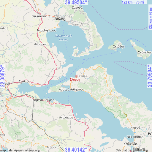
Oreoí GPS coordinates[2]
38° 57' 1.224" North, 23° 5' 30.876" East
| Map corner | latitude | longitude |
|---|---|---|
| Upper-left | 39.49504°, | 22.38879° |
| Center: | 38.95034°, | 23.09191° |
| Lower-right: | 38.40142°, | 23.79504° |
| Map W x H: | 121.6×121.6 km | = 75.6×75.6mi |
| max Lat: | 41.72048° ⇑54.9% North |
| Oreoí: | 38.95034° |
| min Lat: | ⇓45.1% South 34.8346° |
| min Long | Oreoí | max Long |
| 19.40494° | 23.09191° | 29.59361° |
| W 56.9%⇐ | ⇒43.1% E |
Elevation
Elevation of Oreoí is 4 m = 13 ft, and this is 164.9 m = 541 ft below average elevation for this country.
| Max E: |
1439 m = 4721 ft | 97.4% |
| Avg. | 168.9 m = 554 ft | |
| Oreoí | 4 m = 13 ft | |
Min E: |
0 m = 0 ft | 2.6% |
See also: Greece elevation on elevation.city.
Geographical zone
Oreoí is located in North temperate zone (between Tropic of Cancer and the Arctic Circle). Distance of this Northern Tropic circle is 1725 km =1071.9 mi to South.| Distance of | km | miles | from Oreoí |
|---|---|---|---|
| North Pole | 5676.2 | 3527 | to North |
| Arctic Circle | 3070.3 | 1907.8 | to North |
| Tropic Cancer | 1725 | 1071.9 | to South |
| Equator | 4330.9 | 2691.1 | to South |


Nearby cities:
15 places around Oreoí: (largest is in red/bold)
• Aidipsós
8.8 km =5.5 mi,  206°
206°
• Akhíllio
12.9 km =8 mi,  298°
298°
• Arkítsa
23.6 km =14.7 mi,  192°
192°
• Giáltra
13.9 km =8.6 mi,  225°
225°
• Glífa
10.8 km =6.7 mi,  271°
271°
• Istiaía
5.2 km =3.2 mi,  84°
84°
• Loutrá Aidhipsoú
11.1 km =6.9 mi,  200°
200°
• Néos Pírgos
2.3 km =1.4 mi, 226°
• Pelasgía
21.8 km =13.5 mi, 269°
• Pteleós
16.6 km =10.3 mi,  313°
313°
• Roviés
19.7 km =12.2 mi,  142°
142°
• Soúrpi
23.9 km =14.9 mi,  315°
315°
• Tríkeri
16.8 km =10.4 mi,  355°
355°
• Ágios Geórgios Lichádos
22.1 km =13.7 mi,  235°
235°
• Áyios
5.8 km =3.6 mi, 207°
Sources, notices
• [Note1] Compared only with cities in Greece existing in our database
• [Src1] Map data: © OpenStreetMap contributors (CC-BY-SA)
• [Src2] Other city data from geonames.org with taken over terms of usage.
• [Src3] Geographical zone / Annual Mean Temperature by Robert A. Rohde @ Wikipedia
