Skópelos geodata
Skópelos (Thessaly) is a seat of a third-order administrative division; located in Greece in Europe/Athens (GMT+3) time zone. With population of 2,886 people, there are 365 cities with bigger population in this country. Compared to other cities in Greece, 52.5% of cities are located further ↑North; 70.6% of cities are located further ←West and 74.9% of cities have higher elevation than Skópelos. Note1


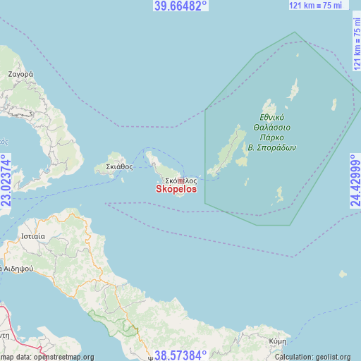
Skópelos GPS coordinates[2]
39° 7' 17.184" North, 23° 43' 36.696" East
| Map corner | latitude | longitude |
|---|---|---|
| Upper-left | 39.66482°, | 23.02374° |
| Center: | 39.12144°, | 23.72686° |
| Lower-right: | 38.57384°, | 24.42999° |
| Map W x H: | 121.3×121.3 km | = 75.4×75.4mi |
| max Lat: | 41.72048° ⇑52.5% North |
| Skópelos: | 39.12144° |
| min Lat: | ⇓47.5% South 34.8346° |
| min Long | Skópelos | max Long |
| 19.40494° | 23.72686° | 29.59361° |
| W 70.6%⇐ | ⇒29.4% E |
Elevation
Elevation of Skópelos is 24 m = 79 ft, and this is 144.9 m = 475 ft below average elevation for this country.
| Max E: |
1439 m = 4721 ft | 74.9% |
| Avg. | 168.9 m = 554 ft | |
| Skópelos | 24 m = 79 ft | |
Min E: |
0 m = 0 ft | 25.1% |
See also: Greece elevation on elevation.city.
Geographical zone
Skópelos is located in North temperate zone (between Tropic of Cancer and the Arctic Circle). Distance of this Northern Tropic circle is 1744 km =1083.7 mi to South.| Distance of | km | miles | from Skópelos |
|---|---|---|---|
| North Pole | 5657.2 | 3515.2 | to North |
| Arctic Circle | 3051.3 | 1896 | to North |
| Tropic Cancer | 1744 | 1083.7 | to South |
| Equator | 4349.9 | 2702.9 | to South |


Nearby cities:
15 places around Skópelos: (largest is in red/bold)
• Agía Ánna
40.6 km =25.2 mi,  224°
224°
• Argalastí
45.3 km =28.1 mi,  284°
284°
• Glóssa
11.3 km =7 mi,  301°
301°
• Istiaía
53 km =32.9 mi,  249°
249°
• Kalá Nerá
56.1 km =34.9 mi,  291°
291°
• Límni
53.1 km =33 mi, 221°
• Makrikápa
56.2 km =34.9 mi,  177°
177°
• Mantoúdi
41.8 km =26 mi,  210°
210°
• Miléai
54.6 km =33.9 mi, 294°
• Patitírion
12.2 km =7.6 mi,  76°
76°
• Prokópi
47.7 km =29.6 mi, 205°
• Roviés
55.1 km =34.2 mi,  231°
231°
• Skiáthos
20.8 km =12.9 mi, 282°
• Tríkeri
56.1 km =34.9 mi,  267°
267°
• Tsagkaráda
56.1 km =34.9 mi, 301°
Sources, notices
• [Note1] Compared only with cities in Greece existing in our database
• [Src1] Map data: © OpenStreetMap contributors (CC-BY-SA)
• [Src2] Other city data from geonames.org with taken over terms of usage.
• [Src3] Geographical zone / Annual Mean Temperature by Robert A. Rohde @ Wikipedia
