Patitírion geodata
Patitírion (Thessaly) is a populated place; located in Greece in Europe/Athens (GMT+3) time zone. With population of 1,628 people, there are 613 cities with bigger population in this country. Compared to other cities in Greece, 51.9% of cities are located further ↑North; 75.1% of cities are located further ←West and 65.2% of cities have higher elevation than Patitírion. Note1


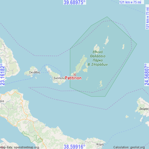
Patitírion GPS coordinates[2]
39° 8' 47.652" North, 23° 51' 53.784" East
| Map corner | latitude | longitude |
|---|---|---|
| Upper-left | 39.68975°, | 23.16182° |
| Center: | 39.14657°, | 23.86494° |
| Lower-right: | 38.59916°, | 24.56807° |
| Map W x H: | 121.3×121.3 km | = 75.4×75.4mi |
| max Lat: | 41.72048° ⇑51.9% North |
| Patitírion: | 39.14657° |
| min Lat: | ⇓48.1% South 34.8346° |
| min Long | Patitírion | max Long |
| 19.40494° | 23.86494° | 29.59361° |
| W 75.1%⇐ | ⇒24.9% E |
Elevation
Elevation of Patitírion is 39 m = 128 ft, and this is 129.9 m = 426 ft below average elevation for this country.
| Max E: |
1439 m = 4721 ft | 65.2% |
| Avg. | 168.9 m = 554 ft | |
| Patitírion | 39 m = 128 ft | |
Min E: |
0 m = 0 ft | 34.8% |
See also: Greece elevation on elevation.city.
Geographical zone
Patitírion is located in North temperate zone (between Tropic of Cancer and the Arctic Circle). Distance of this Northern Tropic circle is 1746.8 km =1085.4 mi to South.| Distance of | km | miles | from Patitírion |
|---|---|---|---|
| North Pole | 5654.4 | 3513.5 | to North |
| Arctic Circle | 3048.5 | 1894.2 | to North |
| Tropic Cancer | 1746.8 | 1085.4 | to South |
| Equator | 4352.7 | 2704.6 | to South |


Nearby cities:
15 places around Patitírion: (largest is in red/bold)
• Agía Ánna
51.3 km =31.9 mi,  231°
231°
• Argalastí
56.4 km =35 mi,  279°
279°
• Glóssa
21.7 km =13.5 mi, 278°
• Istiaía
65.1 km =40.5 mi,  250°
250°
• Kými
60.5 km =37.6 mi,  160°
160°
• Límni
63.5 km =39.5 mi, 228°
• Makrikápa
59.8 km =37.2 mi,  189°
189°
• Mantoúdi
51.1 km =31.8 mi,  220°
220°
• Miléai
64.6 km =40.1 mi,  288°
288°
• Prokópi
56.1 km =34.9 mi, 215°
• Psachná
66 km =41 mi,  196°
196°
• Skiáthos
32.3 km =20.1 mi,  273°
273°
• Skópelos
12.2 km =7.6 mi,  256°
256°
• Skýros
66.1 km =41.1 mi,  114°
114°
• Tsagkaráda
65.3 km =40.6 mi, 294°
Sources, notices
• [Note1] Compared only with cities in Greece existing in our database
• [Src1] Map data: © OpenStreetMap contributors (CC-BY-SA)
• [Src2] Other city data from geonames.org with taken over terms of usage.
• [Src3] Geographical zone / Annual Mean Temperature by Robert A. Rohde @ Wikipedia
