Argalastí geodata
Argalastí (Thessaly) is a seat of a third-order administrative division; located in Greece in Europe/Athens (GMT+3) time zone. With population of 1,285 people, there are 786 cities with bigger population in this country. Compared to other cities in Greece, 50.1% of cities are located further ↑North; 58.8% of cities are located further ←West and 78.3% of cities have lower elevation than Argalastí. Note1


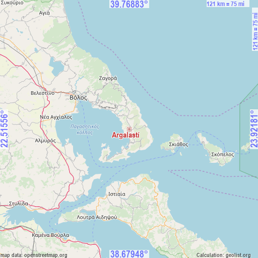
Argalastí GPS coordinates[2]
39° 13' 34.572" North, 23° 13' 7.248" East
| Map corner | latitude | longitude |
|---|---|---|
| Upper-left | 39.76883°, | 22.51556° |
| Center: | 39.22627°, | 23.21868° |
| Lower-right: | 38.67948°, | 23.92181° |
| Map W x H: | 121.1×121.1 km | = 75.2×75.2mi |
| max Lat: | 41.72048° ⇑50.1% North |
| Argalastí: | 39.22627° |
| min Lat: | ⇓49.9% South 34.8346° |
| min Long | Argalastí | max Long |
| 19.40494° | 23.21868° | 29.59361° |
| W 58.8%⇐ | ⇒41.2% E |
Elevation
Elevation of Argalastí is 254 m = 833 ft, and this is 85.1 m = 279 ft above average elevation for this country.
| Max E: |
1439 m = 4721 ft | 21.7% |
| Argalastí | 254 m 833 ft | |
| Avg. | 168.9 m = 554 ft | |
Min E: |
0 m = 0 ft | 78.3% |
See also: Greece elevation on elevation.city.
Geographical zone
Argalastí is located in North temperate zone (between Tropic of Cancer and the Arctic Circle). Distance of this Northern Tropic circle is 1755.6 km =1090.9 mi to South.| Distance of | km | miles | from Argalastí |
|---|---|---|---|
| North Pole | 5645.5 | 3507.9 | to North |
| Arctic Circle | 3039.6 | 1888.7 | to North |
| Tropic Cancer | 1755.6 | 1090.9 | to South |
| Equator | 4361.6 | 2710.2 | to South |


Nearby cities:
15 places around Argalastí: (largest is in red/bold)
• Agriá
21.8 km =13.5 mi,  305°
305°
• Anakasiá
27.1 km =16.8 mi, 309°
• Kalá Nerá
12.2 km =7.6 mi,  316°
316°
• Káto Lekhónia
19.3 km =12 mi, 307°
• Makrinítsa
27.8 km =17.3 mi, 314°
• Miléai
12.6 km =7.8 mi,  332°
332°
• Portariá
26.2 km =16.3 mi, 313°
• Skiáthos
24.5 km =15.2 mi,  106°
106°
• Tríkeri
18.5 km =11.5 mi,  221°
221°
• Tsagkaráda
18.4 km =11.4 mi,  347°
347°
• Volos
28.1 km =17.5 mi,  302°
302°
• Zagorá
26.9 km =16.7 mi,  337°
337°
• Álli Meriá
25.8 km =16 mi, 308°
• Áno Lekhónia
18.1 km =11.2 mi, 308°
• Áno Vólos
26.6 km =16.5 mi, 309°
Sources, notices
• [Note1] Compared only with cities in Greece existing in our database
• [Src1] Map data: © OpenStreetMap contributors (CC-BY-SA)
• [Src2] Other city data from geonames.org with taken over terms of usage.
• [Src3] Geographical zone / Annual Mean Temperature by Robert A. Rohde @ Wikipedia
