Psachná geodata
Psachná (Central Greece) is a seat of a third-order administrative division; located in Greece in Europe/Athens (GMT+3) time zone. With population of 5,828 people, there are 211 cities with bigger population in this country. Compared to other cities in Greece, 60.3% of cities are located further ↑North; 67.8% of cities are located further ←West and 76.1% of cities have higher elevation than Psachná. Note1
Administrative division(s):
- Level 1: Central Greece
- Level 2: Nomós Evvoías
- Level 3: Dimos Dirfys-Messapia


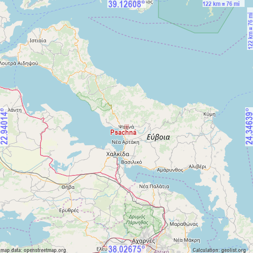
Psachná GPS coordinates[2]
38° 34' 42.672" North, 23° 38' 35.736" East
| Map corner | latitude | longitude |
|---|---|---|
| Upper-left | 39.12608°, | 22.94014° |
| Center: | 38.57852°, | 23.64326° |
| Lower-right: | 38.02675°, | 24.34639° |
| Map W x H: | 122.2×122.2 km | = 75.9×75.9mi |
| max Lat: | 41.72048° ⇑60.3% North |
| Psachná: | 38.57852° |
| min Lat: | ⇓39.7% South 34.8346° |
| min Long | Psachná | max Long |
| 19.40494° | 23.64326° | 29.59361° |
| W 67.8%⇐ | ⇒32.2% E |
Elevation
Elevation of Psachná is 22 m = 72 ft, and this is 146.9 m = 482 ft below average elevation for this country.
| Max E: |
1439 m = 4721 ft | 76.1% |
| Avg. | 168.9 m = 554 ft | |
| Psachná | 22 m = 72 ft | |
Min E: |
0 m = 0 ft | 23.9% |
See also: Greece elevation on elevation.city.
Geographical zone
Psachná is located in North temperate zone (between Tropic of Cancer and the Arctic Circle). Distance of this Northern Tropic circle is 1683.6 km =1046.1 mi to South.| Distance of | km | miles | from Psachná |
|---|---|---|---|
| North Pole | 5717.5 | 3552.7 | to North |
| Arctic Circle | 3111.6 | 1933.5 | to North |
| Tropic Cancer | 1683.6 | 1046.1 | to South |
| Equator | 4289.5 | 2665.4 | to South |


Nearby cities:
15 places around Psachná: (largest is in red/bold)
• Afrátion
14.6 km =9.1 mi,  164°
164°
• Chalkída
13.3 km =8.3 mi,  195°
195°
• Dhrosiá
13.4 km =8.3 mi,  218°
218°
• Fílla
15.6 km =9.7 mi,  167°
167°
• Kastélla
1.4 km =0.9 mi,  229°
229°
• Ksyróvrisi
14.1 km =8.8 mi,  205°
205°
• Makrikápa
10.2 km =6.3 mi,  65°
65°
• Mikrón Vathí
16 km =9.9 mi, 195°
• Mytikas
15 km =9.3 mi,  176°
176°
• Néa Artáki
6.5 km =4 mi,  187°
187°
• Néa Lámpsakos
15.8 km =9.8 mi, 184°
• Paralía Vathéos
18.3 km =11.4 mi, 188°
• Politiká
8.8 km =5.5 mi,  283°
283°
• Vasilikón
17.2 km =10.7 mi, 171°
• Áyios Nikólaos
17.6 km =10.9 mi, 178°
Sources, notices
• [Note1] Compared only with cities in Greece existing in our database
• [Src1] Map data: © OpenStreetMap contributors (CC-BY-SA)
• [Src2] Other city data from geonames.org with taken over terms of usage.
• [Src3] Geographical zone / Annual Mean Temperature by Robert A. Rohde @ Wikipedia
