Pétra geodata
Pétra (Epirus) is a populated place; located in Greece in Europe/Athens (GMT+3) time zone. With population of 515 people, there are 1780 cities with bigger population in this country. Compared to other cities in Greece, 51.6% of cities are located further ↑North; 93.4% of cities are located further →East and 100% of cities have higher elevation than Pétra. Note1


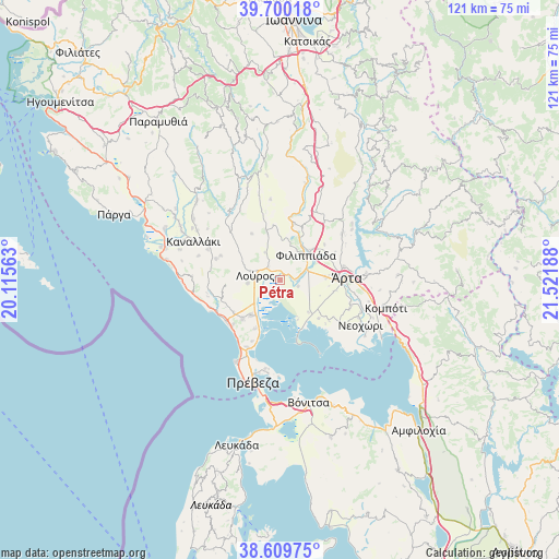
Pétra GPS coordinates[2]
39° 9' 25.488" North, 20° 49' 7.5" East
| Map corner | latitude | longitude |
|---|---|---|
| Upper-left | 39.70018°, | 20.11563° |
| Center: | 39.15708°, | 20.81875° |
| Lower-right: | 38.60975°, | 21.52188° |
| Map W x H: | 121.2×121.2 km | = 75.3×75.3mi |
| max Lat: | 41.72048° ⇑51.6% North |
| Pétra: | 39.15708° |
| min Lat: | ⇓48.4% South 34.8346° |
| min Long | Pétra | max Long |
| 19.40494° | 20.81875° | 29.59361° |
| W 6.6%⇐ | ⇒93.4% E |
Elevation
Elevation of Pétra is 0 m = 0 ft, and this is 168.9 m = 554 ft below average elevation for this country.
| Max E: |
1439 m = 4721 ft | 100% |
| Avg. | 168.9 m = 554 ft | |
| Pétra | 0 m = 0 ft | |
Min E: |
0 m = 0 ft | 0% |
See also: Greece elevation on elevation.city.
Geographical zone
Pétra is located in North temperate zone (between Tropic of Cancer and the Arctic Circle). Distance of this Northern Tropic circle is 1747.9 km =1086.1 mi to South.| Distance of | km | miles | from Pétra |
|---|---|---|---|
| North Pole | 5653.2 | 3512.7 | to North |
| Arctic Circle | 3047.3 | 1893.5 | to North |
| Tropic Cancer | 1747.9 | 1086.1 | to South |
| Equator | 4353.9 | 2705.4 | to South |


Nearby cities:
15 places around Pétra: (largest is in red/bold)
• Chalkiádes
9.8 km =6.1 mi,  88°
88°
• Filippiáda
7.6 km =4.7 mi,  45°
45°
• Kalamiá
9.8 km =6.1 mi,  84°
84°
• Kalóvatos
9.2 km =5.7 mi,  111°
111°
• Kampí
9.7 km =6 mi, 46°
• Loúros
5.5 km =3.4 mi,  280°
280°
• Néa Kerasoúnta
3.3 km =2.1 mi, 89°
• Néa Sampsoúnta
10 km =6.2 mi,  220°
220°
• Néos Oropós
7.1 km =4.4 mi,  264°
264°
• Oropós
8.7 km =5.4 mi,  274°
274°
• Ráchi
8.5 km =5.3 mi,  124°
124°
• Rókka
10.8 km =6.7 mi, 84°
• Stefáni
3.6 km =2.2 mi,  316°
316°
• Thesprotikó
10.8 km =6.7 mi,  344°
344°
• Ágios Spyrídon
4.1 km =2.5 mi, 110°
Sources, notices
• [Note1] Compared only with cities in Greece existing in our database
• [Src1] Map data: © OpenStreetMap contributors (CC-BY-SA)
• [Src2] Other city data from geonames.org with taken over terms of usage.
• [Src3] Geographical zone / Annual Mean Temperature by Robert A. Rohde @ Wikipedia
