Kalóvatos geodata
Kalóvatos (Epirus) is a populated place; located in Greece in Europe/Athens (GMT+3) time zone. With population of 589 people, there are 1603 cities with bigger population in this country. Compared to other cities in Greece, 52.5% of cities are located further ↑North; 91% of cities are located further →East and 89.2% of cities have higher elevation than Kalóvatos. Note1


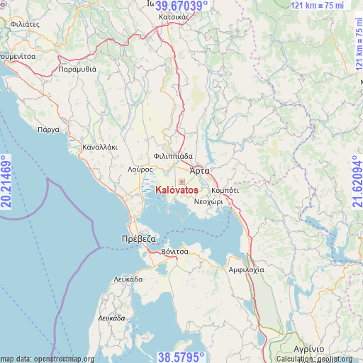
Kalóvatos GPS coordinates[2]
39° 7' 37.416" North, 20° 55' 4.116" East
| Map corner | latitude | longitude |
|---|---|---|
| Upper-left | 39.67039°, | 20.21469° |
| Center: | 39.12706°, | 20.91781° |
| Lower-right: | 38.5795°, | 21.62094° |
| Map W x H: | 121.3×121.3 km | = 75.4×75.4mi |
| max Lat: | 41.72048° ⇑52.5% North |
| Kalóvatos: | 39.12706° |
| min Lat: | ⇓47.5% South 34.8346° |
| min Long | Kalóvatos | max Long |
| 19.40494° | 20.91781° | 29.59361° |
| W 9%⇐ | ⇒91% E |
Elevation
Elevation of Kalóvatos is 9 m = 30 ft, and this is 159.9 m = 525 ft below average elevation for this country.
| Max E: |
1439 m = 4721 ft | 89.2% |
| Avg. | 168.9 m = 554 ft | |
| Kalóvatos | 9 m = 30 ft | |
Min E: |
0 m = 0 ft | 10.8% |
See also: Greece elevation on elevation.city.
Geographical zone
Kalóvatos is located in North temperate zone (between Tropic of Cancer and the Arctic Circle). Distance of this Northern Tropic circle is 1744.6 km =1084 mi to South.| Distance of | km | miles | from Kalóvatos |
|---|---|---|---|
| North Pole | 5656.5 | 3514.8 | to North |
| Arctic Circle | 3050.7 | 1895.6 | to North |
| Tropic Cancer | 1744.6 | 1084 | to South |
| Equator | 4350.5 | 2703.3 | to South |


Nearby cities:
15 places around Kalóvatos: (largest is in red/bold)
• Agía Paraskeví
7 km =4.3 mi,  116°
116°
• Anéza
4.5 km =2.8 mi,  174°
174°
• Chalkiádes
3.9 km =2.4 mi,  19°
19°
• Eleoúsa
4.8 km =3 mi,  53°
53°
• Filippiáda
9.2 km =5.7 mi,  340°
340°
• Grammenítsa
8.3 km =5.2 mi,  39°
39°
• Kalamiá
4.4 km =2.7 mi, 16°
• Kostakioí
3.6 km =2.2 mi,  72°
72°
• Néa Kerasoúnta
6.2 km =3.9 mi,  302°
302°
• Pétra
9.2 km =5.7 mi,  291°
291°
• Ráchi
2.1 km =1.3 mi,  227°
227°
• Rókka
4.9 km =3 mi,  26°
26°
• Ágioi Anárgyroi
9.4 km =5.8 mi,  81°
81°
• Ágios Spyrídon
5.1 km =3.2 mi, 291°
• Árta
6.9 km =4.3 mi,  57°
57°
Sources, notices
• [Note1] Compared only with cities in Greece existing in our database
• [Src1] Map data: © OpenStreetMap contributors (CC-BY-SA)
• [Src2] Other city data from geonames.org with taken over terms of usage.
• [Src3] Geographical zone / Annual Mean Temperature by Robert A. Rohde @ Wikipedia
