Perivóli geodata
Perivóli (Ionian Islands) is a populated place; located in Greece in Europe/Athens (GMT+3) time zone. With population of 1,378 people, there are 735 cities with bigger population in this country. Compared to other cities in Greece, 54.3% of cities are located further ↓South; 97.6% of cities are located further →East and 64.1% of cities have higher elevation than Perivóli. Note1


Perivóli GPS coordinates[2]
39° 25' 9.696" North, 20° 0' 52.884" East
| Map corner | latitude | longitude |
|---|---|---|
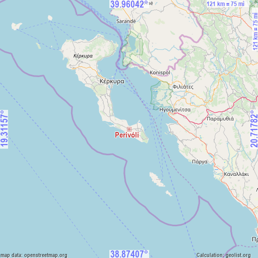
| Upper-left | 39.96042°, | 19.31157° |
| Center: | 39.41936°, | 20.01469° |
| Lower-right: | 38.87407°, | 20.71782° |
| Map W x H: | 120.8×120.8 km | = 75.1×75.1mi |
| max Lat: | 41.72048° ⇑45.7% North |
| Perivóli: | 39.41936° |
| min Lat: | ⇓54.3% South 34.8346° |
| min Long | Perivóli | max Long |
| 19.40494° | 20.01469° | 29.59361° |
| W 2.4%⇐ | ⇒97.6% E |
Elevation
Elevation of Perivóli is 41 m = 135 ft, and this is 127.9 m = 420 ft below average elevation for this country.
| Max E: |
1439 m = 4721 ft | 64.1% |
| Avg. | 168.9 m = 554 ft | |
| Perivóli | 41 m = 135 ft | |
Min E: |
0 m = 0 ft | 35.9% |
See also: Greece elevation on elevation.city.
Geographical zone
Perivóli is located in North temperate zone (between Tropic of Cancer and the Arctic Circle). Distance of this Northern Tropic circle is 1777.1 km =1104.2 mi to South.| Distance of | km | miles | from Perivóli |
|---|---|---|---|
| North Pole | 5624 | 3494.6 | to North |
| Arctic Circle | 3018.2 | 1875.4 | to North |
| Tropic Cancer | 1777.1 | 1104.2 | to South |
| Equator | 4383 | 2723.5 | to South |


Nearby cities:
15 places around Perivóli: (largest is in red/bold)
• Agios Geórgios Argyrádon
5.7 km =3.5 mi,  278°
278°
• Argyrádes
3.7 km =2.3 mi,  298°
298°
• Benítses
16.3 km =10.1 mi,  327°
327°
• Chrysiída
21.5 km =13.4 mi, 332°
• Gastoúri
18.7 km =11.6 mi, 327°
• Kynopiástes
20 km =12.4 mi, 325°
• Káto Garoúna
18.5 km =11.5 mi,  316°
316°
• Kávos
8.6 km =5.3 mi,  112°
112°
• Lefkímmi
4.9 km =3 mi,  84°
84°
• Moraḯtika
10.6 km =6.6 mi,  313°
313°
• Perama
20.2 km =12.6 mi, 334°
• Petrití
4 km =2.5 mi,  339°
339°
• Sývota
20.1 km =12.5 mi,  93°
93°
• Virós
21.5 km =13.4 mi, 328°
• Ágios Matthaíos
14.8 km =9.2 mi, 304°
Sources, notices
• [Note1] Compared only with cities in Greece existing in our database
• [Src1] Map data: © OpenStreetMap contributors (CC-BY-SA)
• [Src2] Other city data from geonames.org with taken over terms of usage.
• [Src3] Geographical zone / Annual Mean Temperature by Robert A. Rohde @ Wikipedia
