Pátmos geodata
Pátmos (South Aegean) is a seat of a third-order administrative division; located in Greece in Europe/Athens (GMT+3) time zone. With population of 541 people, there are 1713 cities with bigger population in this country. Compared to other cities in Greece, 87.7% of cities are located further ↑North; 97.3% of cities are located further ←West and 76.2% of cities have lower elevation than Pátmos. Note1


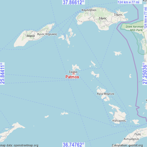
Pátmos GPS coordinates[2]
37° 18' 32.22" North, 26° 32' 50.028" East
| Map corner | latitude | longitude |
|---|---|---|
| Upper-left | 37.86612°, | 25.84411° |
| Center: | 37.30895°, | 26.54723° |
| Lower-right: | 36.74762°, | 27.25036° |
| Map W x H: | 124.4×124.4 km | = 77.3×77.3mi |
| max Lat: | 41.72048° ⇑87.7% North |
| Pátmos: | 37.30895° |
| min Lat: | ⇓12.3% South 34.8346° |
| min Long | Pátmos | max Long |
| 19.40494° | 26.54723° | 29.59361° |
| W 97.3%⇐ | ⇒2.7% E |
Elevation
Elevation of Pátmos is 224 m = 735 ft, and this is 55.1 m = 181 ft above average elevation for this country.
| Max E: |
1439 m = 4721 ft | 23.8% |
| Pátmos | 224 m 735 ft | |
| Avg. | 168.9 m = 554 ft | |
Min E: |
0 m = 0 ft | 76.2% |
See also: Greece elevation on elevation.city.
Geographical zone
Pátmos is located in North temperate zone (between Tropic of Cancer and the Arctic Circle). Distance of this Northern Tropic circle is 1542.4 km =958.4 mi to South.| Distance of | km | miles | from Pátmos |
|---|---|---|---|
| North Pole | 5858.7 | 3640.4 | to North |
| Arctic Circle | 3252.8 | 2021.2 | to North |
| Tropic Cancer | 1542.4 | 958.4 | to South |
| Equator | 4148.4 | 2577.7 | to South |


Nearby cities:
15 places around Pátmos: (largest is in red/bold)
• Agios Kirykos
40.7 km =25.3 mi,  326°
326°
• Agía Marína
32 km =19.9 mi,  122°
122°
• Chóra
54 km =33.6 mi,  35°
35°
• Foúrnoi
30.5 km =19 mi,  348°
348°
• Iraío
49.3 km =30.6 mi, 36°
• Kamara
29.6 km =18.4 mi, 123°
• Kámbos
5 km =3.1 mi,  10°
10°
• Lakkí
33.3 km =20.7 mi,  125°
125°
• Leipsoí
19.6 km =12.2 mi,  98°
98°
• Marathókampos
48.1 km =29.9 mi,  15°
15°
• Megálo Chorió
41.1 km =25.5 mi,  66°
66°
• Pagóndas
47.5 km =29.5 mi,  31°
31°
• Pánormos
51 km =31.7 mi,  137°
137°
• Skála
1.5 km =0.9 mi, 345°
• Xirókampos
35.9 km =22.3 mi, 127°
Sources, notices
• [Note1] Compared only with cities in Greece existing in our database
• [Src1] Map data: © OpenStreetMap contributors (CC-BY-SA)
• [Src2] Other city data from geonames.org with taken over terms of usage.
• [Src3] Geographical zone / Annual Mean Temperature by Robert A. Rohde @ Wikipedia
