Pagóndas geodata
Pagóndas (North Aegean) is a populated place; located in Greece in Europe/Athens (GMT+3) time zone. With population of 518 people, there are 1770 cities with bigger population in this country. Compared to other cities in Greece, 83.4% of cities are located further ↑North; 97.8% of cities are located further ←West and 79.5% of cities have lower elevation than Pagóndas. Note1


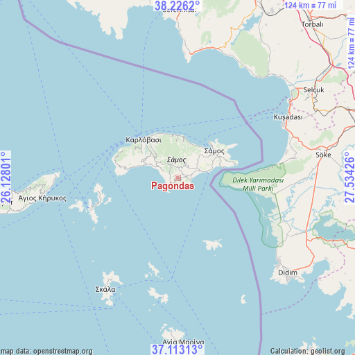
Pagóndas GPS coordinates[2]
37° 40' 18.3" North, 26° 49' 52.068" East
| Map corner | latitude | longitude |
|---|---|---|
| Upper-left | 38.2262°, | 26.12801° |
| Center: | 37.67175°, | 26.83113° |
| Lower-right: | 37.11313°, | 27.53426° |
| Map W x H: | 123.8×123.8 km | = 76.9×76.9mi |
| max Lat: | 41.72048° ⇑83.4% North |
| Pagóndas: | 37.67175° |
| min Lat: | ⇓16.6% South 34.8346° |
| min Long | Pagóndas | max Long |
| 19.40494° | 26.83113° | 29.59361° |
| W 97.8%⇐ | ⇒2.2% E |
Elevation
Elevation of Pagóndas is 272 m = 892 ft, and this is 103.1 m = 338 ft above average elevation for this country.
| Max E: |
1439 m = 4721 ft | 20.5% |
| Pagóndas | 272 m 892 ft | |
| Avg. | 168.9 m = 554 ft | |
Min E: |
0 m = 0 ft | 79.5% |
See also: Greece elevation on elevation.city.
Geographical zone
Pagóndas is located in North temperate zone (between Tropic of Cancer and the Arctic Circle). Distance of this Northern Tropic circle is 1582.8 km =983.5 mi to South.| Distance of | km | miles | from Pagóndas |
|---|---|---|---|
| North Pole | 5818.4 | 3615.4 | to North |
| Arctic Circle | 3212.5 | 1996.2 | to North |
| Tropic Cancer | 1582.8 | 983.5 | to South |
| Equator | 4188.7 | 2602.7 | to South |


Nearby cities:
15 places around Pagóndas: (largest is in red/bold)
• Chóra
7.4 km =4.6 mi,  61°
61°
• Foúrnoi
32.6 km =20.3 mi,  251°
251°
• Iraío
4.5 km =2.8 mi,  100°
100°
• Kokkári
13.1 km =8.1 mi,  24°
24°
• Kontakaíika
16.4 km =10.2 mi,  332°
332°
• Kámbos
42.9 km =26.7 mi,  214°
214°
• Leipsoí
43.6 km =27.1 mi,  187°
187°
• Marathókampos
13.9 km =8.6 mi,  296°
296°
• Megálo Chorió
26.8 km =16.7 mi,  152°
152°
• Mytilinioí
9.1 km =5.7 mi,  47°
47°
• Néon Karlovásion
17.4 km =10.8 mi,  320°
320°
• Palaiókastro
16.6 km =10.3 mi, 63°
• Pythagóreio
10.1 km =6.3 mi,  77°
77°
• Samos
15.8 km =9.8 mi, 54°
• Vathý
15.8 km =9.8 mi, 57°
Sources, notices
• [Note1] Compared only with cities in Greece existing in our database
• [Src1] Map data: © OpenStreetMap contributors (CC-BY-SA)
• [Src2] Other city data from geonames.org with taken over terms of usage.
• [Src3] Geographical zone / Annual Mean Temperature by Robert A. Rohde @ Wikipedia
