Palaiókastro geodata
Palaiókastro (North Aegean) is a populated place; located in Greece in Europe/Athens (GMT+3) time zone. With population of 502 people, there are 1801 cities with bigger population in this country. Compared to other cities in Greece, 81.8% of cities are located further ↑North; 98.6% of cities are located further ←West and 67.4% of cities have lower elevation than Palaiókastro. Note1


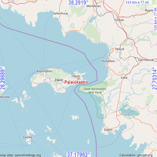
Palaiókastro GPS coordinates[2]
37° 44' 16.62" North, 27° 0' 0.036" East
| Map corner | latitude | longitude |
|---|---|---|
| Upper-left | 38.2919°, | 26.29689° |
| Center: | 37.73795°, | 27.00001° |
| Lower-right: | 37.17982°, | 27.70314° |
| Map W x H: | 123.7×123.7 km | = 76.9×76.9mi |
| max Lat: | 41.72048° ⇑81.8% North |
| Palaiókastro: | 37.73795° |
| min Lat: | ⇓18.2% South 34.8346° |
| min Long | Palaiókastro | max Long |
| 19.40494° | 27.00001° | 29.59361° |
| W 98.6%⇐ | ⇒1.4% E |
Elevation
Elevation of Palaiókastro is 149 m = 489 ft, and this is 19.9 m = 65 ft below average elevation for this country.
| Max E: |
1439 m = 4721 ft | 32.6% |
| Avg. | 168.9 m = 554 ft | |
| Palaiókastro | 149 m = 489 ft | |
Min E: |
0 m = 0 ft | 67.4% |
See also: Greece elevation on elevation.city.
Geographical zone
Palaiókastro is located in North temperate zone (between Tropic of Cancer and the Arctic Circle). Distance of this Northern Tropic circle is 1590.1 km =988 mi to South.| Distance of | km | miles | from Palaiókastro |
|---|---|---|---|
| North Pole | 5811 | 3610.8 | to North |
| Arctic Circle | 3205.1 | 1991.6 | to North |
| Tropic Cancer | 1590.1 | 988 | to South |
| Equator | 4196.1 | 2607.3 | to South |


Nearby cities:
15 places around Palaiókastro: (largest is in red/bold)
• Chóra
9.2 km =5.7 mi,  245°
245°
• Foúrnoi
49 km =30.4 mi, 248°
• Iraío
13.3 km =8.3 mi,  232°
232°
• Kokkári
10.6 km =6.6 mi,  295°
295°
• Kontakaíika
23.5 km =14.6 mi,  287°
287°
• Kámbos
57.9 km =36 mi,  222°
222°
• Leipsoí
54.6 km =33.9 mi,  202°
202°
• Marathókampos
27.3 km =17 mi,  267°
267°
• Megálo Chorió
31.2 km =19.4 mi,  184°
184°
• Mytilinioí
8.2 km =5.1 mi,  261°
261°
• Néon Karlovásion
26.6 km =16.5 mi,  283°
283°
• Pagóndas
16.6 km =10.3 mi,  243°
243°
• Pythagóreio
7.2 km =4.5 mi, 223°
• Samos
2.7 km =1.7 mi,  311°
311°
• Vathý
1.8 km =1.1 mi, 303°
Sources, notices
• [Note1] Compared only with cities in Greece existing in our database
• [Src1] Map data: © OpenStreetMap contributors (CC-BY-SA)
• [Src2] Other city data from geonames.org with taken over terms of usage.
• [Src3] Geographical zone / Annual Mean Temperature by Robert A. Rohde @ Wikipedia
