Myrtiá geodata
Myrtiá (West Greece) is a populated place; located in Greece in Europe/Athens (GMT+3) time zone. With population of 919 people, there are 1106 cities with bigger population in this country. Compared to other cities in Greece, 82.6% of cities are located further ↑North; 85.3% of cities are located further →East and 61.4% of cities have higher elevation than Myrtiá. Note1


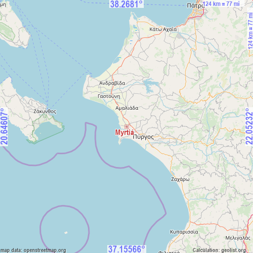
Myrtiá GPS coordinates[2]
37° 42' 50.292" North, 21° 20' 57.084" East
| Map corner | latitude | longitude |
|---|---|---|
| Upper-left | 38.2681°, | 20.64607° |
| Center: | 37.71397°, | 21.34919° |
| Lower-right: | 37.15566°, | 22.05232° |
| Map W x H: | 123.7×123.7 km | = 76.9×76.9mi |
| max Lat: | 41.72048° ⇑82.6% North |
| Myrtiá: | 37.71397° |
| min Lat: | ⇓17.4% South 34.8346° |
| min Long | Myrtiá | max Long |
| 19.40494° | 21.34919° | 29.59361° |
| W 14.7%⇐ | ⇒85.3% E |
Elevation
Elevation of Myrtiá is 46 m = 151 ft, and this is 122.9 m = 403 ft below average elevation for this country.
| Max E: |
1439 m = 4721 ft | 61.4% |
| Avg. | 168.9 m = 554 ft | |
| Myrtiá | 46 m = 151 ft | |
Min E: |
0 m = 0 ft | 38.6% |
See also: Greece elevation on elevation.city.
Geographical zone
Myrtiá is located in North temperate zone (between Tropic of Cancer and the Arctic Circle). Distance of this Northern Tropic circle is 1587.5 km =986.4 mi to South.| Distance of | km | miles | from Myrtiá |
|---|---|---|---|
| North Pole | 5813.7 | 3612.5 | to North |
| Arctic Circle | 3207.8 | 1993.2 | to North |
| Tropic Cancer | 1587.5 | 986.4 | to South |
| Equator | 4193.4 | 2605.7 | to South |


Nearby cities:
15 places around Myrtiá: (largest is in red/bold)
• Alfeioúsa
18.5 km =11.5 mi,  116°
116°
• Amaliáda
9.4 km =5.8 mi,  0°
0°
• Chávari
15.3 km =9.5 mi,  11°
11°
• Epitálio
16.1 km =10 mi,  127°
127°
• Gastoúni
17.5 km =10.9 mi,  330°
330°
• Kardamás
6 km =3.7 mi,  351°
351°
• Karátoula
16.6 km =10.3 mi,  81°
81°
• Katákolo
7 km =4.3 mi,  203°
203°
• Kavásila
19.5 km =12.1 mi,  337°
337°
• Pýrgos
9.2 km =5.7 mi, 118°
• Savália
12.9 km =8 mi, 338°
• Synoikismós Chavaríou
16.1 km =10 mi, 12°
• Traganón
20.7 km =12.9 mi, 351°
• Vartholomió
20.7 km =12.9 mi,  322°
322°
• Varvásaina
14 km =8.7 mi,  109°
109°
Sources, notices
• [Note1] Compared only with cities in Greece existing in our database
• [Src1] Map data: © OpenStreetMap contributors (CC-BY-SA)
• [Src2] Other city data from geonames.org with taken over terms of usage.
• [Src3] Geographical zone / Annual Mean Temperature by Robert A. Rohde @ Wikipedia
