Megísti geodata
Megísti (South Aegean) is a seat of a third-order administrative division; located in Greece in Europe/Athens (GMT+3) time zone. In our database, there are 1823 cities with bigger population. Compared to other cities in Greece, 93.5% of cities are located further ↑North; 100% of cities are located further ←West and 78.7% of cities have higher elevation than Megísti. Note1


Megísti GPS coordinates[2]
36° 8' 56.004" North, 29° 35' 36.996" East
| Map corner | latitude | longitude |
|---|---|---|
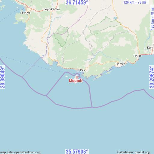
| Upper-left | 36.71459°, | 28.89049° |
| Center: | 36.14889°, | 29.59361° |
| Lower-right: | 35.57908°, | 30.29674° |
| Map W x H: | 126.3×126.3 km | = 78.5×78.5mi |
| max Lat: | 41.72048° ⇑93.5% North |
| Megísti: | 36.14889° |
| min Lat: | ⇓6.5% South 34.8346° |
| min Long | Megísti | max Long |
| 19.40494° | 29.59361° | 29.59361° |
| W 100%⇐ | ⇒0% E |
Elevation
Elevation of Megísti is 19 m = 62 ft, and this is 149.9 m = 492 ft below average elevation for this country.
| Max E: |
1439 m = 4721 ft | 78.7% |
| Avg. | 168.9 m = 554 ft | |
| Megísti | 19 m = 62 ft | |
Min E: |
0 m = 0 ft | 21.3% |
See also: Greece elevation on elevation.city.
Geographical zone
Megísti is located in North temperate zone (between Tropic of Cancer and the Arctic Circle). Distance of this Northern Tropic circle is 1413.5 km =878.3 mi to South.| Distance of | km | miles | from Megísti |
|---|---|---|---|
| North Pole | 5987.7 | 3720.6 | to North |
| Arctic Circle | 3381.8 | 2101.4 | to North |
| Tropic Cancer | 1413.5 | 878.3 | to South |
| Equator | 4019.4 | 2497.5 | to South |


Nearby cities:
15 places around Megísti: (largest is in red/bold)
• Afántou
129.4 km =80.4 mi,  277°
277°
• Apóllona
146.5 km =91 mi,  274°
274°
• Archángelos
132.9 km =82.6 mi, 273°
• Chálki
178 km =110.6 mi, 272°
• Dhamatria
137.9 km =85.7 mi, 280°
• Faliraki
126.8 km =78.8 mi, 279°
• Fanes
146.2 km =90.8 mi, 278°
• Gennadi
150.7 km =93.6 mi,  264°
264°
• Ialysós
132.2 km =82.1 mi, 282°
• Kremastí
135.3 km =84.1 mi, 282°
• Lárdos
141.9 km =88.2 mi, 267°
• Líndos
135.6 km =84.3 mi, 267°
• Ródos
127 km =78.9 mi, 284°
• Sými
165.6 km =102.9 mi,  288°
288°
• Émponas
156.1 km =97 mi, 273°
Sources, notices
• [Note1] Compared only with cities in Greece existing in our database
• [Src1] Map data: © OpenStreetMap contributors (CC-BY-SA)
• [Src2] Other city data from geonames.org with taken over terms of usage.
• [Src3] Geographical zone / Annual Mean Temperature by Robert A. Rohde @ Wikipedia
