Menídi geodata
Menídi (West Greece) is a populated place; located in Greece in Europe/Athens (GMT+3) time zone. With population of 1,110 people, there are 911 cities with bigger population in this country. Compared to other cities in Greece, 54.1% of cities are located further ↑North; 88.7% of cities are located further →East and 78.7% of cities have higher elevation than Menídi. Note1
Administrative division(s):
- Level 1: West Greece
- Level 2: Nomós Aitolías kai Akarnanías
- Level 3: Dimos Amfilochia


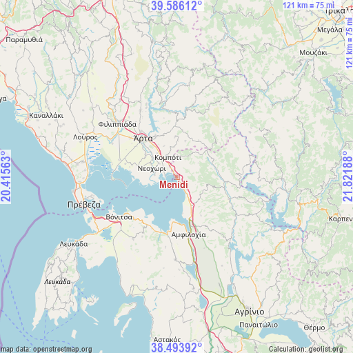
Menídi GPS coordinates[2]
39° 2' 31.668" North, 21° 7' 7.5" East
| Map corner | latitude | longitude |
|---|---|---|
| Upper-left | 39.58612°, | 20.41563° |
| Center: | 39.04213°, | 21.11875° |
| Lower-right: | 38.49392°, | 21.82188° |
| Map W x H: | 121.4×121.4 km | = 75.4×75.4mi |
| max Lat: | 41.72048° ⇑54.1% North |
| Menídi: | 39.04213° |
| min Lat: | ⇓45.9% South 34.8346° |
| min Long | Menídi | max Long |
| 19.40494° | 21.11875° | 29.59361° |
| W 11.3%⇐ | ⇒88.7% E |
Elevation
Elevation of Menídi is 19 m = 62 ft, and this is 149.9 m = 492 ft below average elevation for this country.
| Max E: |
1439 m = 4721 ft | 78.7% |
| Avg. | 168.9 m = 554 ft | |
| Menídi | 19 m = 62 ft | |
Min E: |
0 m = 0 ft | 21.3% |
See also: Greece elevation on elevation.city.
Geographical zone
Menídi is located in North temperate zone (between Tropic of Cancer and the Arctic Circle). Distance of this Northern Tropic circle is 1735.2 km =1078.2 mi to South.| Distance of | km | miles | from Menídi |
|---|---|---|---|
| North Pole | 5666 | 3520.7 | to North |
| Arctic Circle | 3060.1 | 1901.5 | to North |
| Tropic Cancer | 1735.2 | 1078.2 | to South |
| Equator | 4341.1 | 2697.4 | to South |


Nearby cities:
15 places around Menídi: (largest is in red/bold)
• Agía Paraskeví
12.7 km =7.9 mi,  299°
299°
• Akropotamiá
10.3 km =6.4 mi, 304°
• Boúka
13 km =8.1 mi,  171°
171°
• Komméno
7.5 km =4.7 mi,  274°
274°
• Kompóti
7.4 km =4.6 mi,  335°
335°
• Kostakioí
17.4 km =10.8 mi,  307°
307°
• Kríkellos
12 km =7.5 mi,  154°
154°
• Megárchi
11.4 km =7.1 mi, 338°
• Neochóri
9.2 km =5.7 mi,  289°
289°
• Pachykálamos
10.2 km =6.3 mi, 296°
• Péta
15.6 km =9.7 mi,  332°
332°
• Pétra
13.8 km =8.6 mi,  357°
357°
• Selládes
8.2 km =5.1 mi, 334°
• Ágioi Anárgyroi
13.5 km =8.4 mi,  323°
323°
• Árta
17.4 km =10.8 mi, 318°
Sources, notices
• [Note1] Compared only with cities in Greece existing in our database
• [Src1] Map data: © OpenStreetMap contributors (CC-BY-SA)
• [Src2] Other city data from geonames.org with taken over terms of usage.
• [Src3] Geographical zone / Annual Mean Temperature by Robert A. Rohde @ Wikipedia
