Kríkellos geodata
Kríkellos (West Greece) is a populated place; located in Greece in Europe/Athens (GMT+3) time zone. With population of 1,312 people, there are 765 cities with bigger population in this country. Compared to other cities in Greece, 55% of cities are located further ↑North; 88.1% of cities are located further →East and 80.3% of cities have higher elevation than Kríkellos. Note1
Administrative division(s):
- Level 1: West Greece
- Level 2: Nomós Aitolías kai Akarnanías
- Level 3: Dimos Amfilochia


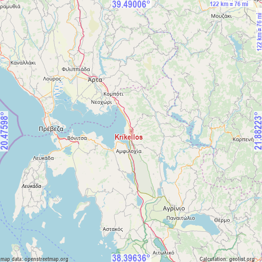
Kríkellos GPS coordinates[2]
38° 56' 43.152" North, 21° 10' 44.76" East
| Map corner | latitude | longitude |
|---|---|---|
| Upper-left | 39.49006°, | 20.47598° |
| Center: | 38.94532°, | 21.1791° |
| Lower-right: | 38.39636°, | 21.88223° |
| Map W x H: | 121.6×121.6 km | = 75.6×75.6mi |
| max Lat: | 41.72048° ⇑55% North |
| Kríkellos: | 38.94532° |
| min Lat: | ⇓45% South 34.8346° |
| min Long | Kríkellos | max Long |
| 19.40494° | 21.1791° | 29.59361° |
| W 11.9%⇐ | ⇒88.1% E |
Elevation
Elevation of Kríkellos is 17 m = 56 ft, and this is 151.9 m = 498 ft below average elevation for this country.
| Max E: |
1439 m = 4721 ft | 80.3% |
| Avg. | 168.9 m = 554 ft | |
| Kríkellos | 17 m = 56 ft | |
Min E: |
0 m = 0 ft | 19.7% |
See also: Greece elevation on elevation.city.
Geographical zone
Kríkellos is located in North temperate zone (between Tropic of Cancer and the Arctic Circle). Distance of this Northern Tropic circle is 1724.4 km =1071.5 mi to South.| Distance of | km | miles | from Kríkellos |
|---|---|---|---|
| North Pole | 5676.7 | 3527.3 | to North |
| Arctic Circle | 3070.9 | 1908.2 | to North |
| Tropic Cancer | 1724.4 | 1071.5 | to South |
| Equator | 4330.3 | 2690.7 | to South |


Nearby cities:
15 places around Kríkellos: (largest is in red/bold)
• Amfilochía
9.6 km =6 mi,  186°
186°
• Boúka
3.8 km =2.4 mi,  236°
236°
• Empesós
15 km =9.3 mi,  54°
54°
• Katoúna
18.6 km =11.6 mi,  197°
197°
• Komméno
17 km =10.6 mi,  311°
311°
• Kompóti
19.3 km =12 mi,  334°
334°
• Menídi
12 km =7.5 mi, 334°
• Neochóri
19.6 km =12.2 mi,  315°
315°
• Paliámpela
20 km =12.4 mi,  258°
258°
• Perdikáki
19.7 km =12.2 mi, 53°
• Sardínia
6.6 km =4.1 mi,  159°
159°
• Selládes
20.2 km =12.6 mi, 334°
• Stános
15.7 km =9.8 mi,  181°
181°
• Thýrio
19.7 km =12.2 mi, 239°
• Trýfos
16.4 km =10.2 mi,  213°
213°
Sources, notices
• [Note1] Compared only with cities in Greece existing in our database
• [Src1] Map data: © OpenStreetMap contributors (CC-BY-SA)
• [Src2] Other city data from geonames.org with taken over terms of usage.
• [Src3] Geographical zone / Annual Mean Temperature by Robert A. Rohde @ Wikipedia
