Magoulítsa geodata
Magoulítsa (Thessaly) is a populated place; located in Greece in Europe/Athens (GMT+3) time zone. With population of 792 people, there are 1281 cities with bigger population in this country. Compared to other cities in Greece, 54.8% of cities are located further ↓South; 77.2% of cities are located further →East and 59.1% of cities have lower elevation than Magoulítsa. Note1


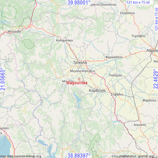
Magoulítsa GPS coordinates[2]
39° 26' 20.796" North, 21° 45' 35.172" East
| Map corner | latitude | longitude |
|---|---|---|
| Upper-left | 39.98001°, | 21.05665° |
| Center: | 39.43911°, | 21.75977° |
| Lower-right: | 38.89397°, | 22.4629° |
| Map W x H: | 120.8×120.8 km | = 75.1×75.1mi |
| max Lat: | 41.72048° ⇑45.2% North |
| Magoulítsa: | 39.43911° |
| min Lat: | ⇓54.8% South 34.8346° |
| min Long | Magoulítsa | max Long |
| 19.40494° | 21.75977° | 29.59361° |
| W 22.8%⇐ | ⇒77.2% E |
Elevation
Elevation of Magoulítsa is 113 m = 371 ft, and this is 55.9 m = 183 ft below average elevation for this country.
| Max E: |
1439 m = 4721 ft | 40.9% |
| Avg. | 168.9 m = 554 ft | |
| Magoulítsa | 113 m = 371 ft | |
Min E: |
0 m = 0 ft | 59.1% |
See also: Greece elevation on elevation.city.
Geographical zone
Magoulítsa is located in North temperate zone (between Tropic of Cancer and the Arctic Circle). Distance of this Northern Tropic circle is 1779.3 km =1105.6 mi to South.| Distance of | km | miles | from Magoulítsa |
|---|---|---|---|
| North Pole | 5621.8 | 3493.2 | to North |
| Arctic Circle | 3016 | 1874.1 | to North |
| Tropic Cancer | 1779.3 | 1105.6 | to South |
| Equator | 4385.2 | 2724.8 | to South |


Nearby cities:
15 places around Magoulítsa: (largest is in red/bold)
• Droseró
8.1 km =5 mi,  348°
348°
• Fanári
4.2 km =2.6 mi,  127°
127°
• Gelánthi
4.5 km =2.8 mi,  269°
269°
• Gómfoi
6.3 km =3.9 mi,  296°
296°
• Kanália
5.7 km =3.5 mi,  142°
142°
• Kraniá
6.5 km =4 mi,  83°
83°
• Lazarína
3.2 km =2 mi,  324°
324°
• Lygariá
9 km =5.6 mi,  313°
313°
• Magoúla
4.1 km =2.5 mi,  66°
66°
• Mavrommáti
5.9 km =3.7 mi,  253°
253°
• Megála Kalývia
6.9 km =4.3 mi,  20°
20°
• Mouriá
6.6 km =4.1 mi,  326°
326°
• Mouzáki
8.3 km =5.2 mi,  262°
262°
• Palaiochóri
6.5 km =4 mi,  58°
58°
• Palaiomonástiro
9.1 km =5.7 mi,  286°
286°
Sources, notices
• [Note1] Compared only with cities in Greece existing in our database
• [Src1] Map data: © OpenStreetMap contributors (CC-BY-SA)
• [Src2] Other city data from geonames.org with taken over terms of usage.
• [Src3] Geographical zone / Annual Mean Temperature by Robert A. Rohde @ Wikipedia
