Mouriá geodata
Mouriá (Thessaly) is a populated place; located in Greece in Europe/Athens (GMT+3) time zone. With population of 714 people, there are 1396 cities with bigger population in this country. Compared to other cities in Greece, 56.2% of cities are located further ↓South; 78% of cities are located further →East and 60.5% of cities have lower elevation than Mouriá. Note1


Mouriá GPS coordinates[2]
39° 29' 20.148" North, 21° 43' 3.036" East
| Map corner | latitude | longitude |
|---|---|---|
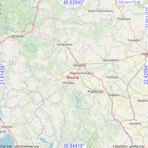
| Upper-left | 40.02945°, | 21.01439° |
| Center: | 39.48893°, | 21.71751° |
| Lower-right: | 38.94418°, | 22.42064° |
| Map W x H: | 120.7×120.7 km | = 75×75mi |
| max Lat: | 41.72048° ⇑43.8% North |
| Mouriá: | 39.48893° |
| min Lat: | ⇓56.2% South 34.8346° |
| min Long | Mouriá | max Long |
| 19.40494° | 21.71751° | 29.59361° |
| W 22%⇐ | ⇒78% E |
Elevation
Elevation of Mouriá is 119 m = 390 ft, and this is 49.9 m = 164 ft below average elevation for this country.
| Max E: |
1439 m = 4721 ft | 39.5% |
| Avg. | 168.9 m = 554 ft | |
| Mouriá | 119 m = 390 ft | |
Min E: |
0 m = 0 ft | 60.5% |
See also: Greece elevation on elevation.city.
Geographical zone
Mouriá is located in North temperate zone (between Tropic of Cancer and the Arctic Circle). Distance of this Northern Tropic circle is 1784.8 km =1109 mi to South.| Distance of | km | miles | from Mouriá |
|---|---|---|---|
| North Pole | 5616.3 | 3489.8 | to North |
| Arctic Circle | 3010.4 | 1870.6 | to North |
| Tropic Cancer | 1784.8 | 1109 | to South |
| Equator | 4390.8 | 2728.3 | to South |


Nearby cities:
15 places around Mouriá: (largest is in red/bold)
• Droseró
3.2 km =2 mi,  41°
41°
• Flamoúli
5.9 km =3.7 mi,  45°
45°
• Fíki
6.1 km =3.8 mi,  299°
299°
• Gelánthi
5.6 km =3.5 mi,  189°
189°
• Gómfoi
3.4 km =2.1 mi,  216°
216°
• Lazarína
3.4 km =2.1 mi,  149°
149°
• Lygariá
2.9 km =1.8 mi,  282°
282°
• Magoulítsa
6.6 km =4.1 mi, 146°
• Mavrommáti
7.5 km =4.7 mi,  195°
195°
• Megála Kalývia
6.1 km =3.8 mi,  81°
81°
• Mouzáki
8 km =5 mi, 215°
• Palaiomonástiro
5.9 km =3.7 mi,  240°
240°
• Pigí
2.8 km =1.7 mi,  329°
329°
• Pyrgetós
7.6 km =4.7 mi,  20°
20°
• Valtinó
8.2 km =5.1 mi,  323°
323°
Sources, notices
• [Note1] Compared only with cities in Greece existing in our database
• [Src1] Map data: © OpenStreetMap contributors (CC-BY-SA)
• [Src2] Other city data from geonames.org with taken over terms of usage.
• [Src3] Geographical zone / Annual Mean Temperature by Robert A. Rohde @ Wikipedia
