Livádion geodata
Livádion (South Aegean) is a populated place; located in Greece in Europe/Athens (GMT+3) time zone. With population of 605 people, there are 1572 cities with bigger population in this country. Compared to other cities in Greece, 88.5% of cities are located further ↑North; 83.7% of cities are located further ←West and 97.4% of cities have higher elevation than Livádion. Note1


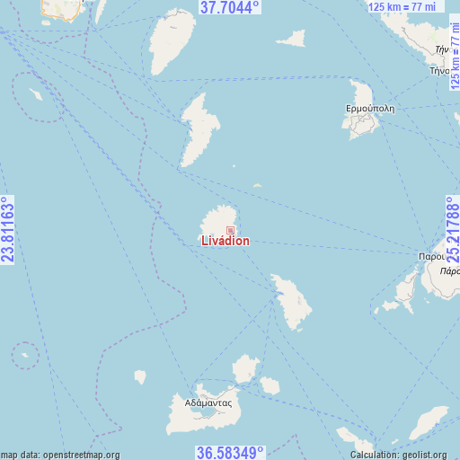
Livádion GPS coordinates[2]
37° 8' 45.672" North, 24° 30' 53.1" East
| Map corner | latitude | longitude |
|---|---|---|
| Upper-left | 37.7044°, | 23.81163° |
| Center: | 37.14602°, | 24.51475° |
| Lower-right: | 36.58349°, | 25.21788° |
| Map W x H: | 124.6×124.6 km | = 77.4×77.4mi |
| max Lat: | 41.72048° ⇑88.5% North |
| Livádion: | 37.14602° |
| min Lat: | ⇓11.5% South 34.8346° |
| min Long | Livádion | max Long |
| 19.40494° | 24.51475° | 29.59361° |
| W 83.7%⇐ | ⇒16.3% E |
Elevation
Elevation of Livádion is 4 m = 13 ft, and this is 164.9 m = 541 ft below average elevation for this country.
| Max E: |
1439 m = 4721 ft | 97.4% |
| Avg. | 168.9 m = 554 ft | |
| Livádion | 4 m = 13 ft | |
Min E: |
0 m = 0 ft | 2.6% |
See also: Greece elevation on elevation.city.
Geographical zone
Livádion is located in North temperate zone (between Tropic of Cancer and the Arctic Circle). Distance of this Northern Tropic circle is 1524.3 km =947.2 mi to South.| Distance of | km | miles | from Livádion |
|---|---|---|---|
| North Pole | 5876.8 | 3651.7 | to North |
| Arctic Circle | 3270.9 | 2032.4 | to North |
| Tropic Cancer | 1524.3 | 947.2 | to South |
| Equator | 4130.3 | 2566.4 | to South |


Nearby cities:
15 places around Livádion: (largest is in red/bold)
• Adámas
47.2 km =29.3 mi,  187°
187°
• Antíparos
51.7 km =32.1 mi,  103°
103°
• Apollonía
26.7 km =16.6 mi,  135°
135°
• Artemón
26.1 km =16.2 mi,  134°
134°
• Ermoúpolis
50.4 km =31.3 mi,  48°
48°
• Kímolos
39.5 km =24.5 mi,  172°
172°
• Kýthnos
30.5 km =19 mi,  345°
345°
• Mílos
45.2 km =28.1 mi, 189°
• Pláka
45.5 km =28.3 mi, 190°
• Péran Triovasálos
45.6 km =28.3 mi, 188°
• Sérifos
1.2 km =0.7 mi,  319°
319°
• Triovasálos
45.2 km =28.1 mi, 189°
• Trypití
46.1 km =28.6 mi, 189°
• Vári
47.6 km =29.6 mi, 53°
• Áno Sýros
50.3 km =31.3 mi, 47°
Sources, notices
• [Note1] Compared only with cities in Greece existing in our database
• [Src1] Map data: © OpenStreetMap contributors (CC-BY-SA)
• [Src2] Other city data from geonames.org with taken over terms of usage.
• [Src3] Geographical zone / Annual Mean Temperature by Robert A. Rohde @ Wikipedia
