Ermoúpolis geodata
Ermoúpolis (South Aegean) is a seat of a first-order administrative division; located in Greece in Europe/Athens (GMT+3) time zone. With population of 11,351 people, there are 132 cities with bigger population in this country. Compared to other cities in Greece, 86.5% of cities are located further ↑North; 86.6% of cities are located further ←West and 99.6% of cities have higher elevation than Ermoúpolis. Note1
Administrative division(s):
- Level 1: South Aegean
- Level 2: Nomós Kykládon
- Level 3: Dimos Syros-Ermoupoli


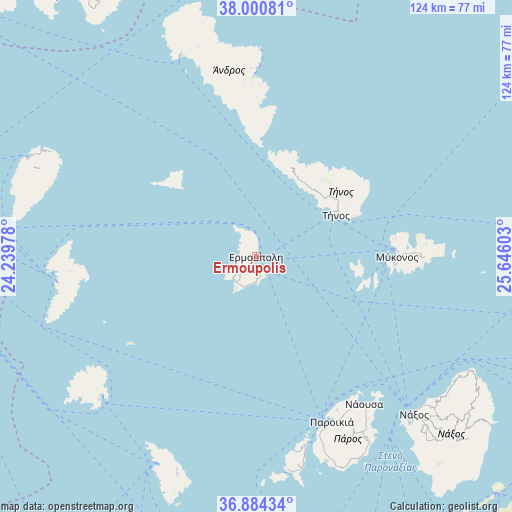
Ermoúpolis GPS coordinates[2]
37° 26' 40.776" North, 24° 56' 34.44" East
| Map corner | latitude | longitude |
|---|---|---|
| Upper-left | 38.00081°, | 24.23978° |
| Center: | 37.44466°, | 24.9429° |
| Lower-right: | 36.88434°, | 25.64603° |
| Map W x H: | 124.1×124.1 km | = 77.1×77.1mi |
| max Lat: | 41.72048° ⇑86.5% North |
| Ermoúpolis: | 37.44466° |
| min Lat: | ⇓13.5% South 34.8346° |
| min Long | Ermoúpolis | max Long |
| 19.40494° | 24.9429° | 29.59361° |
| W 86.6%⇐ | ⇒13.4% E |
Elevation
Elevation of Ermoúpolis is 1 m = 3 ft, and this is 167.9 m = 551 ft below average elevation for this country.
| Max E: |
1439 m = 4721 ft | 99.6% |
| Avg. | 168.9 m = 554 ft | |
| Ermoúpolis | 1 m = 3 ft | |
Min E: |
0 m = 0 ft | 0.4% |
See also: Greece elevation on elevation.city.
Geographical zone
Ermoúpolis is located in North temperate zone (between Tropic of Cancer and the Arctic Circle). Distance of this Northern Tropic circle is 1557.5 km =967.8 mi to South.| Distance of | km | miles | from Ermoúpolis |
|---|---|---|---|
| North Pole | 5843.6 | 3631 | to North |
| Arctic Circle | 3237.7 | 2011.8 | to North |
| Tropic Cancer | 1557.5 | 967.8 | to South |
| Equator | 4163.5 | 2587.1 | to South |


Nearby cities:
15 places around Ermoúpolis: (largest is in red/bold)
• Andros
43.2 km =26.8 mi,  358°
358°
• Klouvás
35.8 km =22.2 mi,  88°
88°
• Kýthnos
45.4 km =28.2 mi,  265°
265°
• Mykonos
34.1 km =21.2 mi, 89°
• Náousa
44.5 km =27.7 mi,  143°
143°
• Ornós
33.6 km =20.9 mi, 93°
• Platýs Gialós
35.4 km =22 mi,  95°
95°
• Plintrí
37 km =23 mi, 93°
• Páros
44.2 km =27.5 mi,  155°
155°
• Toúrlos
34.3 km =21.3 mi, 86°
• Tínos
22 km =13.7 mi,  62°
62°
• Vári
5.2 km =3.2 mi,  173°
173°
• Áno Merá
39.6 km =24.6 mi, 89°
• Áno Sýros
0.9 km =0.6 mi,  312°
312°
• Órmos Korthíou
36.6 km =22.7 mi,  1°
1°
Sources, notices
• [Note1] Compared only with cities in Greece existing in our database
• [Src1] Map data: © OpenStreetMap contributors (CC-BY-SA)
• [Src2] Other city data from geonames.org with taken over terms of usage.
• [Src3] Geographical zone / Annual Mean Temperature by Robert A. Rohde @ Wikipedia
