Kóronos geodata
Kóronos (South Aegean) is a populated place; located in Greece in Europe/Athens (GMT+3) time zone. With population of 526 people, there are 1750 cities with bigger population in this country. Compared to other cities in Greece, 88.6% of cities are located further ↑North; 91.1% of cities are located further ←West and 91.2% of cities have lower elevation than Kóronos. Note1
Administrative division(s):
- Level 1: South Aegean
- Level 2: Nomós Kykládon
- Level 3: Dimos Naxos and Lesser Cyclades


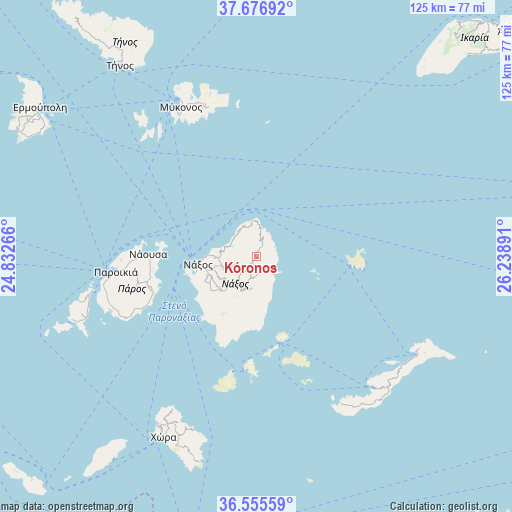
Kóronos GPS coordinates[2]
37° 7' 5.988" North, 25° 32' 8.808" East
| Map corner | latitude | longitude |
|---|---|---|
| Upper-left | 37.67692°, | 24.83266° |
| Center: | 37.11833°, | 25.53578° |
| Lower-right: | 36.55559°, | 26.23891° |
| Map W x H: | 124.7×124.7 km | = 77.5×77.5mi |
| max Lat: | 41.72048° ⇑88.6% North |
| Kóronos: | 37.11833° |
| min Lat: | ⇓11.4% South 34.8346° |
| min Long | Kóronos | max Long |
| 19.40494° | 25.53578° | 29.59361° |
| W 91.1%⇐ | ⇒8.9% E |
Elevation
Elevation of Kóronos is 541 m = 1775 ft, and this is 372.1 m = 1221 ft above average elevation for this country.
| Max E: |
1439 m = 4721 ft | 8.8% |
| Kóronos | 541 m 1775 ft | |
| Avg. | 168.9 m = 554 ft | |
Min E: |
0 m = 0 ft | 91.2% |
See also: Greece elevation on elevation.city.
Geographical zone
Kóronos is located in North temperate zone (between Tropic of Cancer and the Arctic Circle). Distance of this Northern Tropic circle is 1521.3 km =945.3 mi to South.| Distance of | km | miles | from Kóronos |
|---|---|---|---|
| North Pole | 5879.9 | 3653.6 | to North |
| Arctic Circle | 3274 | 2034.4 | to North |
| Tropic Cancer | 1521.3 | 945.3 | to South |
| Equator | 4127.2 | 2564.5 | to South |


Nearby cities:
15 places around Kóronos: (largest is in red/bold)
• Antíparos
41.1 km =25.5 mi,  257°
257°
• Apérathos
5.4 km =3.4 mi,  195°
195°
• Filótion
8.1 km =5 mi, 204°
• Glinádo
13 km =8.1 mi,  246°
246°
• Klouvás
40.7 km =25.3 mi,  335°
335°
• Mykonos
40.7 km =25.3 mi,  333°
333°
• Náousa
26.2 km =16.3 mi,  270°
270°
• Náxos
14.2 km =8.8 mi, 264°
• Ornós
38.9 km =24.2 mi, 330°
• Platýs Gialós
37.1 km =23.1 mi, 332°
• Plintrí
37.4 km =23.2 mi, 335°
• Páros
34.4 km =21.4 mi, 263°
• Vívlos
13.1 km =8.1 mi,  239°
239°
• Ágios Arsénios
14.3 km =8.9 mi, 243°
• Áno Merá
38.9 km =24.2 mi, 340°
Sources, notices
• [Note1] Compared only with cities in Greece existing in our database
• [Src1] Map data: © OpenStreetMap contributors (CC-BY-SA)
• [Src2] Other city data from geonames.org with taken over terms of usage.
• [Src3] Geographical zone / Annual Mean Temperature by Robert A. Rohde @ Wikipedia
