Glinádo geodata
Glinádo (South Aegean) is a populated place; located in Greece in Europe/Athens (GMT+3) time zone. With population of 585 people, there are 1610 cities with bigger population in this country. Compared to other cities in Greece, 89.3% of cities are located further ↑North; 90.2% of cities are located further ←West and 52.3% of cities have lower elevation than Glinádo. Note1
Administrative division(s):
- Level 1: South Aegean
- Level 2: Nomós Kykládon
- Level 3: Dimos Naxos and Lesser Cyclades


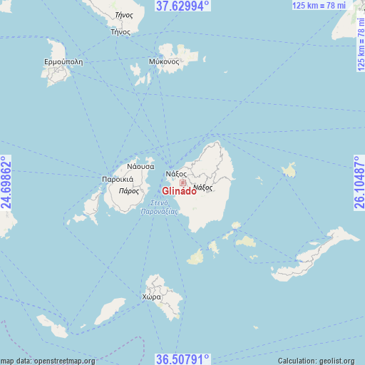
Glinádo GPS coordinates[2]
37° 4' 15.6" North, 25° 24' 6.264" East
| Map corner | latitude | longitude |
|---|---|---|
| Upper-left | 37.62994°, | 24.69862° |
| Center: | 37.071°, | 25.40174° |
| Lower-right: | 36.50791°, | 26.10487° |
| Map W x H: | 124.8×124.8 km | = 77.5×77.5mi |
| max Lat: | 41.72048° ⇑89.3% North |
| Glinádo: | 37.071° |
| min Lat: | ⇓10.7% South 34.8346° |
| min Long | Glinádo | max Long |
| 19.40494° | 25.40174° | 29.59361° |
| W 90.2%⇐ | ⇒9.8% E |
Elevation
Elevation of Glinádo is 90 m = 295 ft, and this is 78.9 m = 259 ft below average elevation for this country.
| Max E: |
1439 m = 4721 ft | 47.7% |
| Avg. | 168.9 m = 554 ft | |
| Glinádo | 90 m = 295 ft | |
Min E: |
0 m = 0 ft | 52.3% |
See also: Greece elevation on elevation.city.
Geographical zone
Glinádo is located in North temperate zone (between Tropic of Cancer and the Arctic Circle). Distance of this Northern Tropic circle is 1516 km =942 mi to South.| Distance of | km | miles | from Glinádo |
|---|---|---|---|
| North Pole | 5885.2 | 3656.9 | to North |
| Arctic Circle | 3279.3 | 2037.7 | to North |
| Tropic Cancer | 1516 | 942 | to South |
| Equator | 4121.9 | 2561.2 | to South |


Nearby cities:
15 places around Glinádo: (largest is in red/bold)
• Antíparos
28.5 km =17.7 mi,  262°
262°
• Apérathos
10.5 km =6.5 mi,  89°
89°
• Filótion
8.8 km =5.5 mi,  104°
104°
• Kóronos
13 km =8.1 mi,  66°
66°
• Mykonos
42.1 km =26.2 mi,  351°
351°
• Náousa
15.4 km =9.6 mi,  291°
291°
• Náxos
4.5 km =2.8 mi,  329°
329°
• Ornós
39.9 km =24.8 mi, 349°
• Platýs Gialós
38.6 km =24 mi, 352°
• Plintrí
39.5 km =24.5 mi, 354°
• Páros
22.4 km =13.9 mi,  273°
273°
• Vívlos
1.5 km =0.9 mi,  157°
157°
• Ágios Arsénios
1.4 km =0.9 mi,  220°
220°
• Áno Merá
42 km =26.1 mi,  358°
358°
• Íos
39 km =24.2 mi,  195°
195°
Sources, notices
• [Note1] Compared only with cities in Greece existing in our database
• [Src1] Map data: © OpenStreetMap contributors (CC-BY-SA)
• [Src2] Other city data from geonames.org with taken over terms of usage.
• [Src3] Geographical zone / Annual Mean Temperature by Robert A. Rohde @ Wikipedia
